|
|
市場調査レポート
商品コード
1722739
地球衛星観測市場レポート:ソリューション、エンドユーザー、地域別、2025年~2033年Satellite-based Earth Observation Market Report by Solution (Data, Value Added Services), End User (Defense and Intelligence, Infrastructure and Engineering, Agriculture, Energy and Power, and Others), and Region 2025-2033 |
||||||
カスタマイズ可能
|
|||||||
| 地球衛星観測市場レポート:ソリューション、エンドユーザー、地域別、2025年~2033年 |
|
出版日: 2025年05月01日
発行: IMARC
ページ情報: 英文 137 Pages
納期: 2~3営業日
|
全表示
- 概要
- 図表
- 目次
世界の地球衛星観測市場規模は2024年に37億米ドルに達しました。今後、IMARC Groupは、市場は2033年までに58億米ドルに達し、2025年から2033年にかけて5.04%の成長率(CAGR)を示すと予測しています。正確な気象予測や環境モニタリングに対する需要の高まりが市場を刺激しています。
地球衛星観測では、リモートセンシング技術や測量技術を使用して、地球の物理的、化学的、生物学的システムに関連する重要な情報を収集します。これらの情報は、気候パターン、天候の変化、災害、自然災害、石油や鉱物の埋蔵量、水資源の利用可能性などを予測するために使用されます。現在、世界中のいくつかの組織が、データ分析のための正確で貴重な洞察を得るために、地球衛星観測システムに依存しています。
地球衛星観測の市場動向:
耕作可能な土地の減少や食糧安全保障への懸念の高まりから、各国政府はスマート農業や精密農業の導入を奨励しています。これは、情報誘導型農業における地球衛星観測システムの応用を拡大する重要な要因の一つです。さらに、森林は、雪崩、地滑り、落石などの自然災害から人々やインフラを守るために重要な役割を果たしているため、森林の劣化は、保護された森林地域の持続可能な管理のために地球衛星観測の必要性を促しています。これとは別に、地球衛星観測は高解像度の衛星画像データを提供し、都市の変化プロセスを監視するのに役立つため、持続可能な都市計画や農村開発で支持を集めています。このほか、国土監視活動、飛行場監視、重要インフラ保護、犯罪地図作成など、防衛・情報分野における高精度データセットの広範な利用が市場成長に寄与しています。さらに、宇宙ベースの技術は、国際民間航空交通の安全性と効率性をサポートし向上させるために、航空宇宙産業において極めて重要です。これは、旅客航空輸送量の増加と相まって、市場にプラスの影響を与えています。さらに、自動自動運転車の新たな動向は、ナビゲーションやその他のアプリケーションのための自動車への地球衛星観測システムの採用を促進すると予想されます。
本レポートで扱う主な質問
- 地球衛星観測市場の規模は?
- 2025-2033年における地球衛星観測世界市場の予想成長率は?
- 地球衛星観測の世界市場を牽引する主要因は?
- 地球衛星観測の世界市場成長に対するCOVID-19の影響は?
- 地球衛星観測の世界市場におけるソリューション別の区分は?
- 地球衛星観測の世界市場におけるエンドユーザー別の区分は?
- 地球衛星観測の世界市場における主要地域は?
- 地球衛星観測の世界市場における主要プレイヤー/企業は?
目次
第1章 序文
第2章 調査範囲と調査手法
- 調査の目的
- ステークホルダー
- データソース
- 一次情報
- 二次情報
- 市場推定
- ボトムアップアプローチ
- トップダウンアプローチ
- 調査手法
第3章 エグゼクティブサマリー
第4章 イントロダクション
- 概要
- 主要業界動向
第5章 世界の地球衛星観測市場
- 市場概要
- 市場実績
- COVID-19の影響
- 市場予測
第6章 市場内訳:ソリューション別
- データ
- 付加価値サービス
第7章 市場内訳:エンドユーザー別
- 防衛・情報
- インフラ・エンジニアリング
- 農業
- エネルギー・電力
- その他
第8章 市場内訳:地域別
- 北米
- 米国
- カナダ
- アジア太平洋地域
- 中国
- 日本
- インド
- 韓国
- オーストラリア
- インドネシア
- その他
- 欧州
- ドイツ
- フランス
- 英国
- イタリア
- スペイン
- ロシア
- その他
- ラテンアメリカ
- ブラジル
- メキシコ
- その他
- 中東・アフリカ
- 市場内訳:国別
第9章 SWOT分析
- 概要
- 強み
- 弱み
- 機会
- 脅威
第10章 バリューチェーン分析
第11章 ポーターのファイブフォース分析
- 概要
- 買い手の交渉力
- 供給企業の交渉力
- 競合の程度
- 新規参入業者の脅威
- 代替品の脅威
第12章 価格分析
第13章 競合情勢
- 市場構造
- 主要企業
- 主要企業のプロファイル
- Airbus SE
- BAE Systems plc
- GeoOptics Inc.
- ImageSat International N.V.
- L3Harris Technologies Inc.
- Lockheed Martin Corporation
- Maxar Technologies Inc.
- Northrop Grumman Corporation
- OHB System AG(OHB SE)
- Planet Labs PBC
- Raytheon Technologies Corporation
- Thales Group
List of Figures
- Figure 1: Global: Satellite-based Earth Observation Market: Major Drivers and Challenges
- Figure 2: Global: Satellite-based Earth Observation Market: Sales Value (in Billion USD), 2019-2024
- Figure 3: Global: Satellite-based Earth Observation Market Forecast: Sales Value (in Billion USD), 2025-2033
- Figure 4: Global: Satellite-based Earth Observation Market: Breakup by Solution (in %), 2024
- Figure 5: Global: Satellite-based Earth Observation Market: Breakup by End User (in %), 2024
- Figure 6: Global: Satellite-based Earth Observation Market: Breakup by Region (in %), 2024
- Figure 7: Global: Satellite-based Earth Observation (Data) Market: Sales Value (in Million USD), 2019 & 2024
- Figure 8: Global: Satellite-based Earth Observation (Data) Market Forecast: Sales Value (in Million USD), 2025-2033
- Figure 9: Global: Satellite-based Earth Observation (Value Added Services) Market: Sales Value (in Million USD), 2019 & 2024
- Figure 10: Global: Satellite-based Earth Observation (Value Added Services) Market Forecast: Sales Value (in Million USD), 2025-2033
- Figure 11: Global: Satellite-based Earth Observation (Defense and Intelligence) Market: Sales Value (in Million USD), 2019 & 2024
- Figure 12: Global: Satellite-based Earth Observation (Defense and Intelligence) Market Forecast: Sales Value (in Million USD), 2025-2033
- Figure 13: Global: Satellite-based Earth Observation (Infrastructure and Engineering) Market: Sales Value (in Million USD), 2019 & 2024
- Figure 14: Global: Satellite-based Earth Observation (Infrastructure and Engineering) Market Forecast: Sales Value (in Million USD), 2025-2033
- Figure 15: Global: Satellite-based Earth Observation (Agriculture) Market: Sales Value (in Million USD), 2019 & 2024
- Figure 16: Global: Satellite-based Earth Observation (Agriculture) Market Forecast: Sales Value (in Million USD), 2025-2033
- Figure 17: Global: Satellite-based Earth Observation (Energy and Power) Market: Sales Value (in Million USD), 2019 & 2024
- Figure 18: Global: Satellite-based Earth Observation (Energy and Power) Market Forecast: Sales Value (in Million USD), 2025-2033
- Figure 19: Global: Satellite-based Earth Observation (Other End Users) Market: Sales Value (in Million USD), 2019 & 2024
- Figure 20: Global: Satellite-based Earth Observation (Other End Users) Market Forecast: Sales Value (in Million USD), 2025-2033
- Figure 21: North America: Satellite-based Earth Observation Market: Sales Value (in Million USD), 2019 & 2024
- Figure 22: North America: Satellite-based Earth Observation Market Forecast: Sales Value (in Million USD), 2025-2033
- Figure 23: United States: Satellite-based Earth Observation Market: Sales Value (in Million USD), 2019 & 2024
- Figure 24: United States: Satellite-based Earth Observation Market Forecast: Sales Value (in Million USD), 2025-2033
- Figure 25: Canada: Satellite-based Earth Observation Market: Sales Value (in Million USD), 2019 & 2024
- Figure 26: Canada: Satellite-based Earth Observation Market Forecast: Sales Value (in Million USD), 2025-2033
- Figure 27: Asia-Pacific: Satellite-based Earth Observation Market: Sales Value (in Million USD), 2019 & 2024
- Figure 28: Asia-Pacific: Satellite-based Earth Observation Market Forecast: Sales Value (in Million USD), 2025-2033
- Figure 29: China: Satellite-based Earth Observation Market: Sales Value (in Million USD), 2019 & 2024
- Figure 30: China: Satellite-based Earth Observation Market Forecast: Sales Value (in Million USD), 2025-2033
- Figure 31: Japan: Satellite-based Earth Observation Market: Sales Value (in Million USD), 2019 & 2024
- Figure 32: Japan: Satellite-based Earth Observation Market Forecast: Sales Value (in Million USD), 2025-2033
- Figure 33: India: Satellite-based Earth Observation Market: Sales Value (in Million USD), 2019 & 2024
- Figure 34: India: Satellite-based Earth Observation Market Forecast: Sales Value (in Million USD), 2025-2033
- Figure 35: South Korea: Satellite-based Earth Observation Market: Sales Value (in Million USD), 2019 & 2024
- Figure 36: South Korea: Satellite-based Earth Observation Market Forecast: Sales Value (in Million USD), 2025-2033
- Figure 37: Australia: Satellite-based Earth Observation Market: Sales Value (in Million USD), 2019 & 2024
- Figure 38: Australia: Satellite-based Earth Observation Market Forecast: Sales Value (in Million USD), 2025-2033
- Figure 39: Indonesia: Satellite-based Earth Observation Market: Sales Value (in Million USD), 2019 & 2024
- Figure 40: Indonesia: Satellite-based Earth Observation Market Forecast: Sales Value (in Million USD), 2025-2033
- Figure 41: Others: Satellite-based Earth Observation Market: Sales Value (in Million USD), 2019 & 2024
- Figure 42: Others: Satellite-based Earth Observation Market Forecast: Sales Value (in Million USD), 2025-2033
- Figure 43: Europe: Satellite-based Earth Observation Market: Sales Value (in Million USD), 2019 & 2024
- Figure 44: Europe: Satellite-based Earth Observation Market Forecast: Sales Value (in Million USD), 2025-2033
- Figure 45: Germany: Satellite-based Earth Observation Market: Sales Value (in Million USD), 2019 & 2024
- Figure 46: Germany: Satellite-based Earth Observation Market Forecast: Sales Value (in Million USD), 2025-2033
- Figure 47: France: Satellite-based Earth Observation Market: Sales Value (in Million USD), 2019 & 2024
- Figure 48: France: Satellite-based Earth Observation Market Forecast: Sales Value (in Million USD), 2025-2033
- Figure 49: United Kingdom: Satellite-based Earth Observation Market: Sales Value (in Million USD), 2019 & 2024
- Figure 50: United Kingdom: Satellite-based Earth Observation Market Forecast: Sales Value (in Million USD), 2025-2033
- Figure 51: Italy: Satellite-based Earth Observation Market: Sales Value (in Million USD), 2019 & 2024
- Figure 52: Italy: Satellite-based Earth Observation Market Forecast: Sales Value (in Million USD), 2025-2033
- Figure 53: Spain: Satellite-based Earth Observation Market: Sales Value (in Million USD), 2019 & 2024
- Figure 54: Spain: Satellite-based Earth Observation Market Forecast: Sales Value (in Million USD), 2025-2033
- Figure 55: Russia: Satellite-based Earth Observation Market: Sales Value (in Million USD), 2019 & 2024
- Figure 56: Russia: Satellite-based Earth Observation Market Forecast: Sales Value (in Million USD), 2025-2033
- Figure 57: Others: Satellite-based Earth Observation Market: Sales Value (in Million USD), 2019 & 2024
- Figure 58: Others: Satellite-based Earth Observation Market Forecast: Sales Value (in Million USD), 2025-2033
- Figure 59: Latin America: Satellite-based Earth Observation Market: Sales Value (in Million USD), 2019 & 2024
- Figure 60: Latin America: Satellite-based Earth Observation Market Forecast: Sales Value (in Million USD), 2025-2033
- Figure 61: Brazil: Satellite-based Earth Observation Market: Sales Value (in Million USD), 2019 & 2024
- Figure 62: Brazil: Satellite-based Earth Observation Market Forecast: Sales Value (in Million USD), 2025-2033
- Figure 63: Mexico: Satellite-based Earth Observation Market: Sales Value (in Million USD), 2019 & 2024
- Figure 64: Mexico: Satellite-based Earth Observation Market Forecast: Sales Value (in Million USD), 2025-2033
- Figure 65: Others: Satellite-based Earth Observation Market: Sales Value (in Million USD), 2019 & 2024
- Figure 66: Others: Satellite-based Earth Observation Market Forecast: Sales Value (in Million USD), 2025-2033
- Figure 67: Middle East and Africa: Satellite-based Earth Observation Market: Sales Value (in Million USD), 2019 & 2024
- Figure 68: Middle East and Africa: Satellite-based Earth Observation Market: Breakup by Country (in %), 2024
- Figure 69: Middle East and Africa: Satellite-based Earth Observation Market Forecast: Sales Value (in Million USD), 2025-2033
- Figure 70: Global: Satellite-based Earth Observation Industry: SWOT Analysis
- Figure 71: Global: Satellite-based Earth Observation Industry: Value Chain Analysis
- Figure 72: Global: Satellite-based Earth Observation Industry: Porter's Five Forces Analysis
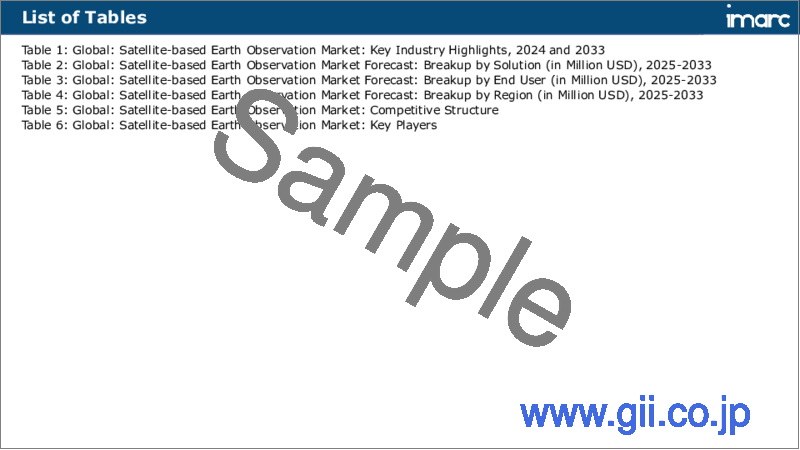
List of Tables
- Table 1: Global: Satellite-based Earth Observation Market: Key Industry Highlights, 2024 and 2033
- Table 2: Global: Satellite-based Earth Observation Market Forecast: Breakup by Solution (in Million USD), 2025-2033
- Table 3: Global: Satellite-based Earth Observation Market Forecast: Breakup by End User (in Million USD), 2025-2033
- Table 4: Global: Satellite-based Earth Observation Market Forecast: Breakup by Region (in Million USD), 2025-2033
- Table 5: Global: Satellite-based Earth Observation Market: Competitive Structure
- Table 6: Global: Satellite-based Earth Observation Market: Key Players
The global satellite-based earth observation market size reached USD 3.7 Billion in 2024. Looking forward, IMARC Group expects the market to reach USD 5.8 Billion by 2033, exhibiting a growth rate (CAGR) of 5.04% during 2025-2033. The increasing demand for accurate weather forecasting and environmental monitoring is stimulating the market.
Satellite-based earth observation involves gathering vital information pertaining to the physical, chemical, and biological systems of the Earth using remote sensing technologies and surveying techniques. The information is used to predict climate patterns, weather changes, disasters, natural calamities, oil and mineral deposits, and the availability of water resources. Nowadays, several organizations across the globe are relying on satellite-based earth observation systems to gain accurate and valuable insights for data analytics.
Satellite-based Earth Observation Market Trends:
Governments of numerous economies are encouraging the adoption of smart and precision farming practices on account of the declining arable land and rising food security concerns. This represents one of the key factors expanding the application of satellite-based earth observation systems in information-guided agriculture. Moreover, as forest covers play a vital role in protecting people and infrastructure against natural hazards, such as avalanches, landslides, and rockfalls, forest degradation is catalyzing the need for satellite-based earth observation for the sustainable management of protected forest areas. Apart from this, satellite-based earth observation is gaining traction in sustainable urban planning and rural development as it provides high-resolution satellite imagery data that helps in monitoring urban change processes. Besides this, extensive utilization of high-accuracy datasets in defense and intelligence for land surveillance activities, airfields monitoring, critical infrastructure protection, and crime mapping is contributing to the market growth. Furthermore, space-based technologies are crucial in the aerospace industry to support and increase the safety and efficiency of international civilian air traffic. This, in confluence with the growing passenger air traffic, is influencing the market positively. Additionally, the emerging trend of automated self-driving vehicles is anticipated to drive the adoption of satellite-based earth observation systems in cars for navigation and other applications.
Key Market Segmentation:
Breakup by Solution:
- Data
- Value Added Services
Breakup by End User:
- Defense and Intelligence
- Infrastructure and Engineering
- Agriculture
- Energy and Power
- Others
Breakup by Region:
- North America
- United States
- Canada
- Asia-Pacific
- China
- Japan
- India
- South Korea
- Australia
- Indonesia
- Others
- Europe
- Germany
- France
- United Kingdom
- Italy
- Spain
- Russia
- Others
- Latin America
- Brazil
- Mexico
- Others
- Middle East and Africa
Competitive Landscape:
The competitive landscape of the industry has also been examined along with the profiles of the key players being Airbus SE, BAE Systems plc, GeoOptics Inc., ImageSat International N.V., L3Harris Technologies Inc., Lockheed Martin Corporation, Maxar Technologies Inc., Northrop Grumman Corporation, OHB System AG (OHB SE), Planet Labs PBC, Raytheon Technologies Corporation and Thales Group.
Key Questions Answered in This Report
- 1.How big is the satellite-based earth observation market?
- 2.What is the expected growth rate of the global satellite-based earth observation market during 2025-2033?
- 3.What are the key factors driving the global satellite-based earth observation market?
- 4.What has been the impact of COVID-19 on the global satellite-based earth observation market growth?
- 5.What is the breakup of the global satellite-based earth observation market based on the solution?
- 6.What is the breakup of the global satellite-based earth observation market based on the end user?
- 7.What are the key regions in the global satellite-based earth observation market?
- 8.Who are the key players/companies in the global satellite-based earth observation market?
Table of Contents
1 Preface
2 Scope and Methodology
- 2.1 Objectives of the Study
- 2.2 Stakeholders
- 2.3 Data Sources
- 2.3.1 Primary Sources
- 2.3.2 Secondary Sources
- 2.4 Market Estimation
- 2.4.1 Bottom-Up Approach
- 2.4.2 Top-Down Approach
- 2.5 Forecasting Methodology
3 Executive Summary
4 Introduction
- 4.1 Overview
- 4.2 Key Industry Trends
5 Global Satellite-based Earth Observation Market
- 5.1 Market Overview
- 5.2 Market Performance
- 5.3 Impact of COVID-19
- 5.4 Market Forecast
6 Market Breakup by Solution
- 6.1 Data
- 6.1.1 Market Trends
- 6.1.2 Market Forecast
- 6.2 Value Added Services
- 6.2.1 Market Trends
- 6.2.2 Market Forecast
7 Market Breakup by End User
- 7.1 Defense and Intelligence
- 7.1.1 Market Trends
- 7.1.2 Market Forecast
- 7.2 Infrastructure and Engineering
- 7.2.1 Market Trends
- 7.2.2 Market Forecast
- 7.3 Agriculture
- 7.3.1 Market Trends
- 7.3.2 Market Forecast
- 7.4 Energy and Power
- 7.4.1 Market Trends
- 7.4.2 Market Forecast
- 7.5 Others
- 7.5.1 Market Trends
- 7.5.2 Market Forecast
8 Market Breakup by Region
- 8.1 North America
- 8.1.1 United States
- 8.1.1.1 Market Trends
- 8.1.1.2 Market Forecast
- 8.1.2 Canada
- 8.1.2.1 Market Trends
- 8.1.2.2 Market Forecast
- 8.1.1 United States
- 8.2 Asia-Pacific
- 8.2.1 China
- 8.2.1.1 Market Trends
- 8.2.1.2 Market Forecast
- 8.2.2 Japan
- 8.2.2.1 Market Trends
- 8.2.2.2 Market Forecast
- 8.2.3 India
- 8.2.3.1 Market Trends
- 8.2.3.2 Market Forecast
- 8.2.4 South Korea
- 8.2.4.1 Market Trends
- 8.2.4.2 Market Forecast
- 8.2.5 Australia
- 8.2.5.1 Market Trends
- 8.2.5.2 Market Forecast
- 8.2.6 Indonesia
- 8.2.6.1 Market Trends
- 8.2.6.2 Market Forecast
- 8.2.7 Others
- 8.2.7.1 Market Trends
- 8.2.7.2 Market Forecast
- 8.2.1 China
- 8.3 Europe
- 8.3.1 Germany
- 8.3.1.1 Market Trends
- 8.3.1.2 Market Forecast
- 8.3.2 France
- 8.3.2.1 Market Trends
- 8.3.2.2 Market Forecast
- 8.3.3 United Kingdom
- 8.3.3.1 Market Trends
- 8.3.3.2 Market Forecast
- 8.3.4 Italy
- 8.3.4.1 Market Trends
- 8.3.4.2 Market Forecast
- 8.3.5 Spain
- 8.3.5.1 Market Trends
- 8.3.5.2 Market Forecast
- 8.3.6 Russia
- 8.3.6.1 Market Trends
- 8.3.6.2 Market Forecast
- 8.3.7 Others
- 8.3.7.1 Market Trends
- 8.3.7.2 Market Forecast
- 8.3.1 Germany
- 8.4 Latin America
- 8.4.1 Brazil
- 8.4.1.1 Market Trends
- 8.4.1.2 Market Forecast
- 8.4.2 Mexico
- 8.4.2.1 Market Trends
- 8.4.2.2 Market Forecast
- 8.4.3 Others
- 8.4.3.1 Market Trends
- 8.4.3.2 Market Forecast
- 8.4.1 Brazil
- 8.5 Middle East and Africa
- 8.5.1 Market Trends
- 8.5.2 Market Breakup by Country
- 8.5.3 Market Forecast
9 SWOT Analysis
- 9.1 Overview
- 9.2 Strengths
- 9.3 Weaknesses
- 9.4 Opportunities
- 9.5 Threats
10 Value Chain Analysis
11 Porters Five Forces Analysis
- 11.1 Overview
- 11.2 Bargaining Power of Buyers
- 11.3 Bargaining Power of Suppliers
- 11.4 Degree of Competition
- 11.5 Threat of New Entrants
- 11.6 Threat of Substitutes
12 Price Analysis
13 Competitive Landscape
- 13.1 Market Structure
- 13.2 Key Players
- 13.3 Profiles of Key Players
- 13.3.1 Airbus SE
- 13.3.1.1 Company Overview
- 13.3.1.2 Product Portfolio
- 13.3.1.3 Financials
- 13.3.1.4 SWOT Analysis
- 13.3.2 BAE Systems plc
- 13.3.2.1 Company Overview
- 13.3.2.2 Product Portfolio
- 13.3.2.3 Financials
- 13.3.2.4 SWOT Analysis
- 13.3.3 GeoOptics Inc.
- 13.3.3.1 Company Overview
- 13.3.3.2 Product Portfolio
- 13.3.4 ImageSat International N.V.
- 13.3.4.1 Company Overview
- 13.3.4.2 Product Portfolio
- 13.3.5 L3Harris Technologies Inc.
- 13.3.5.1 Company Overview
- 13.3.5.2 Product Portfolio
- 13.3.5.3 Financials
- 13.3.6 Lockheed Martin Corporation
- 13.3.6.1 Company Overview
- 13.3.6.2 Product Portfolio
- 13.3.6.3 Financials
- 13.3.6.4 SWOT Analysis
- 13.3.7 Maxar Technologies Inc.
- 13.3.7.1 Company Overview
- 13.3.7.2 Product Portfolio
- 13.3.7.3 Financials
- 13.3.8 Northrop Grumman Corporation
- 13.3.8.1 Company Overview
- 13.3.8.2 Product Portfolio
- 13.3.8.3 Financials
- 13.3.8.4 SWOT Analysis
- 13.3.9 OHB System AG (OHB SE)
- 13.3.9.1 Company Overview
- 13.3.9.2 Product Portfolio
- 13.3.10 Planet Labs PBC
- 13.3.10.1 Company Overview
- 13.3.10.2 Product Portfolio
- 13.3.11 Raytheon Technologies Corporation
- 13.3.11.1 Company Overview
- 13.3.11.2 Product Portfolio
- 13.3.11.3 Financials
- 13.3.11.4 SWOT Analysis
- 13.3.12 Thales Group
- 13.3.12.1 Company Overview
- 13.3.12.2 Product Portfolio
- 13.3.12.3 Financials
- 13.3.12.4 SWOT Analysis
- 13.3.1 Airbus SE


