|
|
市場調査レポート
商品コード
1489428
土地測量機器の世界市場予測(~2030年):製品別、ソリューション別、技術別、用途別、エンドユーザー別、地域別の世界分析Land Survey Equipment Market Forecasts to 2030 - Global Analysis By Product, Solution, Technology, Application, End User and by Geography |
||||||
カスタマイズ可能
|
|||||||
| 土地測量機器の世界市場予測(~2030年):製品別、ソリューション別、技術別、用途別、エンドユーザー別、地域別の世界分析 |
|
出版日: 2024年06月06日
発行: Stratistics Market Research Consulting
ページ情報: 英文 200+ Pages
納期: 2~3営業日
|
全表示
- 概要
- 図表
- 目次
Stratistics MRCによると、世界の土地測量機器市場は2023年に90億米ドルを占め、予測期間中にCAGR 7.2%で成長し、2030年には146億米ドルに達する見込みです。
土地測量機器とは、測量士が地表の測定や地図作成に使用する専門的なツールや機器を指します。これらの機器には、セオドライト、トータルステーション、GPSレシーバー、水準器などが含まれます。これらの機器は、距離、角度、高度を正確に決定するために不可欠であり、地図の作成、境界の確定、建設プロジェクトの実施に不可欠です。最新の土地測量機器には、GPSやレーザースキャンのような高度な技術が統合されていることが多く、測量作業の精度と効率が向上しています。
米国国勢調査局と住宅都市開発省によると、2021年に販売された新築住宅は76万2,000戸で、そのほとんどが一戸建て住宅でした。
高まるインフラ整備
市場は、先端技術に焦点を当てたインフラ開発の急増を目の当たりにしています。道路、橋、鉄道、空港、ビルなどのインフラ・プロジェクトでは、適切な計画、設計、建設を確実に行うために正確な土地測量が必要とされます。世界各国の政府や民間セクターは、経済成長、都市化、輸送のニーズをサポートするため、インフラプロジェクトに多額の投資を行っています。こうしたプロジェクトでは正確な地理空間データが必要とされるため、市場の需要は拡大しています。
レンタルやリースの選択肢が限られている
市場では、レンタルやリースの選択肢が限られていることが多く、一時的な機器の利用を必要とする企業や専門家にとって課題となっています。このような希少性は、需要が高いこと、在庫が限られていること、またはサプライヤーが設定した厳しい資格基準に起因することがあります。その結果、ユーザーは、短期プロジェクトや既存のリソースを補うために必要な機器の入手が困難になり、測量作業の遅延やコスト増につながる可能性があります。
技術の進歩
高精度GPSシステムは現在、センチメートル・レベルの精度を提供し、測量効率と精度を向上させています。統合ソフトウェアソリューションはデータ処理を自動化し、手作業によるミスを減らし、プロジェクトのタイムラインを向上させる。さらに、IoTの統合により、リアルタイムのモニタリングとデータ共有が可能になり、コラボレーションと意思決定が促進されます。これらの技術革新は、土地測量のプロセスを合理化し、業界の生産性と品質を向上させます。したがって、これが市場の成長を後押ししている側面です。
高い初期費用
同市場では、しばしば多額の初期費用が課題となっています。これらの費用には、トータルステーション、GPS/GNSSレシーバー、レーザースキャナーなどの高度な測量ツールの調達や、データ処理・解析用のソフトウェアライセンスなどが含まれます。このような経済的な障壁があるにもかかわらず、最新の測量技術が提供する精度と効率は、この業界の多くの専門家や企業にとって、これらの初期費用を正当化するものです。
COVID-19の影響:
COVID-19の流行は土地測量機器市場に大きな影響を与え、サプライチェーンの混乱、プロジェクトの遅延、インフラへの投資の減少を引き起こしました。このため、世界的に建設活動が減速し、測量機器や技術に対する需要が一時的に落ち込みました。しかし、市場は遠隔測量ソリューションの採用や建設・インフラプロジェクトの緩やかな回復によって回復力を示しており、パンデミック後の状況でも安定した成長の可能性を示しています。
パイプレーザーセグメントが予測期間中最大になる見込み
パイプレーザーセグメントは、予測期間中最大になると見られています。パイプレーザーは、その精度と地下建設プロジェクトにおける効率性により、土地測量機器市場でますます人気が高まっています。これらのレーザーは、パイプの正確なアライメントと勾配制御を提供し、スムーズな施工を保証し、コストのかかるエラーを低減します。この動向は、建設プロセスを合理化し、プロジェクトの成果を高める高性能ツールに対する需要の高まりを反映しています。
予測期間中、林業セグメントのCAGRが最も高くなる見込み
予測期間中、CAGRが最も高くなると予想されるのは林業セグメントです。サステイナブル施業を重視する傾向が強まる中、林業用途に合わせた土地調査ツールの需要が高まっています。これらのツールには、樹木の高さ測定用のレーザースキャナー、森林境界のマッピング用のGPSシステム、航空調査用のドローンなどが含まれます。林業用土地調査機器に先端技術が統合されることで、効率的な資源管理と環境保全が保証されます。
最大のシェアを占める地域
北米は、様々な産業における地理空間データの需要増加に牽引され、予測期間中最大の市場シェアを占めると予測されています。道路、鉄道、橋、建物、公共施設の建設などのインフラプロジェクトが、土地測量機器の需要を促進しています。市場の形成には、政府の規制や基準が重要な役割を果たしています。土地利用、環境影響評価、敷地境界、安全基準に関する規制は、測量技術の採用に影響を与えています。
CAGRが最も高い地域:
予測期間中、アジア太平洋が最も高いCAGRを維持すると予測されています。同地域は都市化率が高く、都市への人口移動が増加しています。この動向により、都市計画、土地利用管理、不動産開発のための土地測量サービスの需要が高まっています。同地域の市場は競争が激しく、国内外のメーカーやサプライヤーが市場シェアを争っています。このような競争は、技術革新や製品改良につながることが多いです。
無料のカスタマイズサービス:
本レポートをご購読のお客様には、以下の無料カスタマイズオプションのいずれかをご利用いただけます。
- 企業プロファイル
- 追加市場参入企業の包括的プロファイリング(3社まで)
- 主要企業のSWOT分析(3社まで)
- 地域セグメンテーション
- 顧客の関心に応じた主要国の市場推定・予測・CAGR(注:フィージビリティチェックによる)
- 競合ベンチマーキング
- 製品ポートフォリオ、地理的プレゼンス、戦略的提携別の主要企業のベンチマーキング
目次
第1章 エグゼクティブサマリー
第2章 序文
- 概要
- ステークホルダー
- 調査範囲
- 調査手法
- データ鉱業
- データ分析
- データ検証
- 調査アプローチ
- 調査情報源
- 1次調査情報源
- 2次調査情報源
- 前提条件
第3章 市場動向分析
- イントロダクション
- 促進要因
- 抑制要因
- 機会
- 脅威
- 製品分析
- 技術分析
- 用途分析
- エンドユーザー分析
- 新興市場
- COVID-19の影響
第4章 ポーターのファイブフォース分析
- 供給企業の交渉力
- 買い手の交渉力
- 代替品の脅威
- 新規参入業者の脅威
- 競争企業間の敵対関係
第5章 世界の土地測量機器市場:製品別
- イントロダクション
- 全地球航法衛星システム(GNSS)システム
- トータルステーションとセオドライト
- 3Dレーザースキャナー
- 無人航空機(UAV)
- パイプレーザー
- その他
第6章 世界の土地測量機器市場:ソリューション別
- イントロダクション
- ハードウェア
- ソフトウェア
- サービス
第7章 世界の土地測量機器市場:技術別
- イントロダクション
- リモートセンシング
- 先進型測量技術
- 従来型測量機器
- その他
第8章 世界の土地測量機器市場:用途別
- イントロダクション
- 試験
- 監視
- レイアウトポイント
- 容積計算
- その他
第9章 世界の土地測量機器市場:エンドユーザー別
- イントロダクション
- 鉱業と建設
- 林業
- 科学と地質研究
- 精密農業
- 災害管理
- 輸送
- エネルギーと電力
- その他
第10章 世界の土地測量機器市場:地域別
- イントロダクション
- 北米
- 米国
- カナダ
- メキシコ
- 欧州
- ドイツ
- 英国
- イタリア
- フランス
- スペイン
- その他の欧州
- アジア太平洋
- 日本
- 中国
- インド
- オーストラリア
- ニュージーランド
- 韓国
- その他のアジア太平洋
- 南米
- アルゼンチン
- ブラジル
- チリ
- その他の南米
- 中東・アフリカ
- サウジアラビア
- アラブ首長国連邦
- カタール
- 南アフリカ
- その他の中東・アフリカ
第11章 主要開発
- 契約、パートナーシップ、コラボレーション、合弁事業
- 買収と合併
- 新製品発売
- 事業拡大
- その他の主要戦略
第12章 企業プロファイリング
- Pentax
- Hexagon AB
- Topcon Positioning Systems
- Garmin Ltd.
- Nikon Corporation
- John Deere
- Faro Technologies
- Geomax Positioning
- Trimble Inc.
- Stonex
- Carlson Software
- Kolida Instrument Co., Ltd.
- Ruide Surveying Instrument Co., Ltd.
- Nedo Corporation
- Geneq Inc.
List of Tables
- Table 1 Global Land Survey Equipment Market Outlook, By Region (2021-2030) ($MN)
- Table 2 Global Land Survey Equipment Market Outlook, By Product (2021-2030) ($MN)
- Table 3 Global Land Survey Equipment Market Outlook, By Global Navigation Satellite Systems (GNSS) Systems (2021-2030) ($MN)
- Table 4 Global Land Survey Equipment Market Outlook, By Total Stations & Theodolites (2021-2030) ($MN)
- Table 5 Global Land Survey Equipment Market Outlook, By 3D Laser Scanners (2021-2030) ($MN)
- Table 6 Global Land Survey Equipment Market Outlook, By Unmanned Aerial Vehicles (UAVs) (2021-2030) ($MN)
- Table 7 Global Land Survey Equipment Market Outlook, By Pipe Lasers (2021-2030) ($MN)
- Table 8 Global Land Survey Equipment Market Outlook, By Other Products (2021-2030) ($MN)
- Table 9 Global Land Survey Equipment Market Outlook, By Solution (2021-2030) ($MN)
- Table 10 Global Land Survey Equipment Market Outlook, By Hardware (2021-2030) ($MN)
- Table 11 Global Land Survey Equipment Market Outlook, By Software (2021-2030) ($MN)
- Table 12 Global Land Survey Equipment Market Outlook, By Services (2021-2030) ($MN)
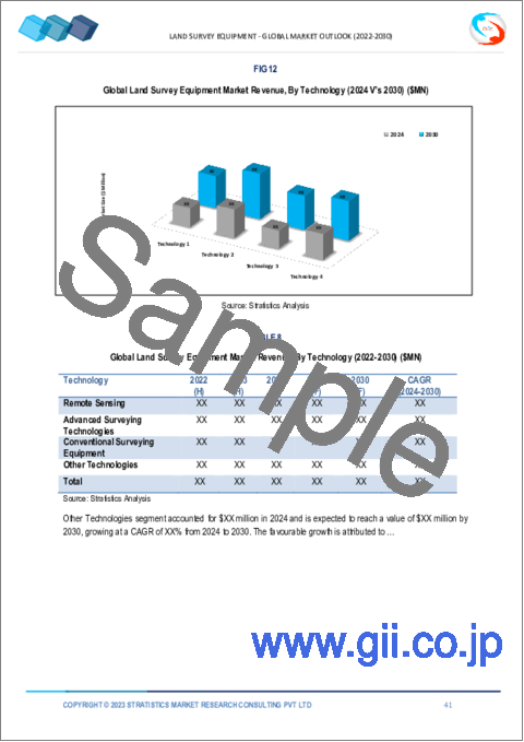
- Table 13 Global Land Survey Equipment Market Outlook, By Technology (2021-2030) ($MN)
- Table 14 Global Land Survey Equipment Market Outlook, By Remote Sensing (2021-2030) ($MN)
- Table 15 Global Land Survey Equipment Market Outlook, By Advanced Surveying Technologies (2021-2030) ($MN)
- Table 16 Global Land Survey Equipment Market Outlook, By Conventional Surveying Equipment (2021-2030) ($MN)
- Table 17 Global Land Survey Equipment Market Outlook, By Other Technologies (2021-2030) ($MN)
- Table 18 Global Land Survey Equipment Market Outlook, By Application (2021-2030) ($MN)
- Table 19 Global Land Survey Equipment Market Outlook, By Inspection (2021-2030) ($MN)
- Table 20 Global Land Survey Equipment Market Outlook, By Monitoring (2021-2030) ($MN)
- Table 21 Global Land Survey Equipment Market Outlook, By Layout Points (2021-2030) ($MN)
- Table 22 Global Land Survey Equipment Market Outlook, By Volumetric Calculations (2021-2030) ($MN)
- Table 23 Global Land Survey Equipment Market Outlook, By Other Applications (2021-2030) ($MN)
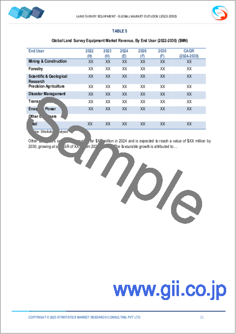
- Table 24 Global Land Survey Equipment Market Outlook, By End User (2021-2030) ($MN)
- Table 25 Global Land Survey Equipment Market Outlook, By Mining & Construction (2021-2030) ($MN)
- Table 26 Global Land Survey Equipment Market Outlook, By Forestry (2021-2030) ($MN)
- Table 27 Global Land Survey Equipment Market Outlook, By Scientific & Geological Research (2021-2030) ($MN)
- Table 28 Global Land Survey Equipment Market Outlook, By Precision Agriculture (2021-2030) ($MN)
- Table 29 Global Land Survey Equipment Market Outlook, By Disaster Management (2021-2030) ($MN)
- Table 30 Global Land Survey Equipment Market Outlook, By Transportation (2021-2030) ($MN)
- Table 31 Global Land Survey Equipment Market Outlook, By Energy & Power (2021-2030) ($MN)
- Table 32 Global Land Survey Equipment Market Outlook, By Other End Users (2021-2030) ($MN)
Note: Tables for North America, Europe, APAC, South America, and Middle East & Africa Regions are also represented in the same manner as above.
According to Stratistics MRC, the Global Land Survey Equipment Market is accounted for $9.0 billion in 2023 and is expected to reach $14.6 billion by 2030 growing at a CAGR of 7.2% during the forecast period. Land survey equipment refers to the specialized tools and instruments used by surveyors to measure and map the Earth's surface. These instruments include theodolites, total stations, GPS receivers, and levels, among others. They are crucial for accurately determining distances, angles, and elevations, which are essential for creating maps, establishing boundaries, and conducting construction projects. Modern land survey equipment often integrates advanced technologies like GPS and laser scanning, enhancing precision and efficiency in surveying tasks.
According to the US Census Bureau and the Department of Housing and Urban Development, in 2021, ~762,000 new homes were sold in the US, most of which were single-family houses.
Market Dynamics:
Driver:
Rising infrastructure development
The market is witnessing a surge in infrastructure development, with a focus on advanced technologies. Infrastructure projects such as roads, bridges, railways, airports, and buildings require accurate land surveying to ensure proper planning, design, and construction. Governments and private sectors globally are investing heavily in infrastructure projects to support economic growth, urbanization, and transportation needs. This translates to a growing demand for the market as these projects require accurate geospatial data.
Restraint:
Limited rental and leasing options
In the market, rental and leasing options are often limited, creating challenges for businesses and professionals in need of temporary equipment access. This scarcity can stem from high demand, limited inventory, or stringent eligibility criteria set by suppliers. As a result, users may face difficulties in acquiring the necessary equipment for short-term projects or to supplement existing resources, leading to potential delays or increased costs in surveying operations.
Opportunity:
Advancements in technology
High-precision GPS systems now offer centimeter-level accuracy, enhancing survey efficiency and accuracy. Integrated software solutions automate data processing, reducing manual errors and enhancing project timelines. Additionally, IoT integration enables real-time monitoring and data sharing, fostering collaboration and decision-making. These innovations collectively streamline land surveying processes, driving productivity and quality in the industry. Thus, this is the aspect propelling the growth of the market.
Threat:
High initial costs
The market presents a challenge with high initial costs, often reaching substantial figures. These expenses encompass the procurement of advanced surveying tools like total stations, GPS/GNSS receivers, and laser scanners, alongside software licenses for data processing and analysis. Despite these financial barriers, the accuracy and efficiency offered by modern surveying technologies justify these initial costs for many professionals and companies in the industry.
Covid-19 Impact:
The COVID-19 pandemic significantly affected the Land Survey Equipment market, causing disruptions in supply chains, project delays, and reduced investments in infrastructure. This led to a temporary downturn in demand for surveying instruments and technologies as construction activities slowed down worldwide. However, the market has shown resilience with the adoption of remote surveying solutions and a gradual recovery in construction and infrastructure projects, indicating a potential for steady growth in the post-pandemic landscape.
The pipe lasers segment is expected to be the largest during the forecast period
The pipe lasers segment is expected to be the largest during the forecast period. Pipe lasers are becoming increasingly popular in the land survey equipment market due to their precision and efficiency in underground construction projects. These lasers offer accurate alignment and grade control for pipes, ensuring smooth installation and reducing costly errors. This trend reflects a growing demand for high-performance tools that streamline construction processes and enhance project outcomes.
The forestry segment is expected to have the highest CAGR during the forecast period
The forestry segment is expected to have the highest CAGR during the forecast period. With the increasing emphasis on sustainable practices, land survey tools tailored for forestry applications are in high demand. These tools include laser scanners for tree height measurement, GPS systems for mapping forest boundaries, and drones for aerial surveys. The integration of advanced technology in forestry land survey equipment ensures efficient resource management and environmental conservation.
Region with largest share:
North America is projected to hold the largest market share during the forecast period driven by increasing demand for geospatial data in various industries. Infrastructure projects such as construction of roads, railways, bridges, buildings, and utilities drive the demand for land survey equipment. Government regulations and standards play a crucial role in shaping the market. Regulations related to land use, environmental impact assessments, property boundaries, and safety standards influence the adoption of surveying technologies.
Region with highest CAGR:
Asia Pacific is projected to hold the highest CAGR over the forecast period. The region is experiencing high rates of urbanization, with a growing population moving to cities. This trend has increased the demand for land surveying services for urban planning, land use management, and property development. The market in the region is competitive, with both local and international manufacturers and suppliers vying for market share. This competition often leads to technological innovation and improved product offerings.
Key players in the market
Some of the key players in Land Survey Equipment market include Pentax , Hexagon AB, Topcon Positioning Systems, Garmin Ltd., Nikon Corporation, John Deere, Faro Technologies, Geomax Positioning, Trimble Inc., Stonex, Carlson Software, Kolida Instrument Co., Ltd., Ruide Surveying Instrument Co., Ltd., Nedo Corporation and Geneq Inc.
Key Developments:
In February 2024, John Deere unveiled a groundbreaking collaboration with Leica Geosystems, a Hexagon subsidiary, aimed at revolutionizing the digitalization of the heavy construction sector. This synergistic partnership capitalizes on the core competencies of both entities, ushering in a new era of technological advancement and service delivery for construction practitioners globally.
In August 2023, Hexagon AB announced its new Leica BLK2FLY Indoor empowering indoor scanning for comprehensive digital twin creation. The enhanced BLK2FLY now delivers unparalleled autonomy, enabling seamless scanning of entire structures both indoors and outdoors.
Products Covered:
- Global Navigation Satellite Systems (GNSS) Systems
- Total Stations & Theodolites
- 3D Laser Scanners
- Unmanned Aerial Vehicles (UAVs)
- Pipe Lasers
- Other Products
Solutions Covered:
- Hardware
- Software
- Services
Technologies Covered:
- Remote Sensing
- Advanced Surveying Technologies
- Conventional Surveying Equipment
- Other Technologies
Applications Covered:
- Inspection
- Monitoring
- Layout Points
- Volumetric Calculations
- Other Applications
End Users Covered:
- Mining & Construction
- Forestry
- Scientific & Geological Research
- Precision Agriculture
- Disaster Management
- Transportation
- Energy & Power
- Other End Users
Regions Covered:
- North America
- US
- Canada
- Mexico
- Europe
- Germany
- UK
- Italy
- France
- Spain
- Rest of Europe
- Asia Pacific
- Japan
- China
- India
- Australia
- New Zealand
- South Korea
- Rest of Asia Pacific
- South America
- Argentina
- Brazil
- Chile
- Rest of South America
- Middle East & Africa
- Saudi Arabia
- UAE
- Qatar
- South Africa
- Rest of Middle East & Africa
What our report offers:
- Market share assessments for the regional and country-level segments
- Strategic recommendations for the new entrants
- Covers Market data for the years 2021, 2022, 2023, 2026, and 2030
- Market Trends (Drivers, Constraints, Opportunities, Threats, Challenges, Investment Opportunities, and recommendations)
- Strategic recommendations in key business segments based on the market estimations
- Competitive landscaping mapping the key common trends
- Company profiling with detailed strategies, financials, and recent developments
- Supply chain trends mapping the latest technological advancements
Free Customization Offerings:
All the customers of this report will be entitled to receive one of the following free customization options:
- Company Profiling
- Comprehensive profiling of additional market players (up to 3)
- SWOT Analysis of key players (up to 3)
- Regional Segmentation
- Market estimations, Forecasts and CAGR of any prominent country as per the client's interest (Note: Depends on feasibility check)
- Competitive Benchmarking
- Benchmarking of key players based on product portfolio, geographical presence, and strategic alliances
Table of Contents
1 Executive Summary
2 Preface
- 2.1 Abstract
- 2.2 Stake Holders
- 2.3 Research Scope
- 2.4 Research Methodology
- 2.4.1 Data Mining
- 2.4.2 Data Analysis
- 2.4.3 Data Validation
- 2.4.4 Research Approach
- 2.5 Research Sources
- 2.5.1 Primary Research Sources
- 2.5.2 Secondary Research Sources
- 2.5.3 Assumptions
3 Market Trend Analysis
- 3.1 Introduction
- 3.2 Drivers
- 3.3 Restraints
- 3.4 Opportunities
- 3.5 Threats
- 3.6 Product Analysis
- 3.7 Technology Analysis
- 3.8 Application Analysis
- 3.9 End User Analysis
- 3.10 Emerging Markets
- 3.11 Impact of Covid-19
4 Porters Five Force Analysis
- 4.1 Bargaining power of suppliers
- 4.2 Bargaining power of buyers
- 4.3 Threat of substitutes
- 4.4 Threat of new entrants
- 4.5 Competitive rivalry
5 Global Land Survey Equipment Market, By Product
- 5.1 Introduction
- 5.2 Global Navigation Satellite Systems (GNSS) Systems
- 5.3 Total Stations & Theodolites
- 5.4 3D Laser Scanners
- 5.5 Unmanned Aerial Vehicles (UAVs)
- 5.6 Pipe Lasers
- 5.7 Other Products
6 Global Land Survey Equipment Market, By Solution
- 6.1 Introduction
- 6.2 Hardware
- 6.3 Software
- 6.4 Services
7 Global Land Survey Equipment Market, By Technology
- 7.1 Introduction
- 7.2 Remote Sensing
- 7.3 Advanced Surveying Technologies
- 7.4 Conventional Surveying Equipment
- 7.5 Other Technologies
8 Global Land Survey Equipment Market, By Application
- 8.1 Introduction
- 8.2 Inspection
- 8.3 Monitoring
- 8.4 Layout Points
- 8.5 Volumetric Calculations
- 8.6 Other Applications
9 Global Land Survey Equipment Market, By End User
- 9.1 Introduction
- 9.2 Mining & Construction
- 9.3 Forestry
- 9.4 Scientific & Geological Research
- 9.5 Precision Agriculture
- 9.6 Disaster Management
- 9.7 Transportation
- 9.8 Energy & Power
- 9.9 Other End Users
10 Global Land Survey Equipment Market, By Geography
- 10.1 Introduction
- 10.2 North America
- 10.2.1 US
- 10.2.2 Canada
- 10.2.3 Mexico
- 10.3 Europe
- 10.3.1 Germany
- 10.3.2 UK
- 10.3.3 Italy
- 10.3.4 France
- 10.3.5 Spain
- 10.3.6 Rest of Europe
- 10.4 Asia Pacific
- 10.4.1 Japan
- 10.4.2 China
- 10.4.3 India
- 10.4.4 Australia
- 10.4.5 New Zealand
- 10.4.6 South Korea
- 10.4.7 Rest of Asia Pacific
- 10.5 South America
- 10.5.1 Argentina
- 10.5.2 Brazil
- 10.5.3 Chile
- 10.5.4 Rest of South America
- 10.6 Middle East & Africa
- 10.6.1 Saudi Arabia
- 10.6.2 UAE
- 10.6.3 Qatar
- 10.6.4 South Africa
- 10.6.5 Rest of Middle East & Africa
11 Key Developments
- 11.1 Agreements, Partnerships, Collaborations and Joint Ventures
- 11.2 Acquisitions & Mergers
- 11.3 New Product Launch
- 11.4 Expansions
- 11.5 Other Key Strategies
12 Company Profiling
- 12.1 Pentax
- 12.2 Hexagon AB
- 12.3 Topcon Positioning Systems
- 12.4 Garmin Ltd.
- 12.5 Nikon Corporation
- 12.6 John Deere
- 12.7 Faro Technologies
- 12.8 Geomax Positioning
- 12.9 Trimble Inc.
- 12.10 Stonex
- 12.11 Carlson Software
- 12.12 Kolida Instrument Co., Ltd.
- 12.13 Ruide Surveying Instrument Co., Ltd.
- 12.14 Nedo Corporation
- 12.15 Geneq Inc.


