|
|
市場調査レポート
商品コード
1357045
精密農業向け画像技術の世界市場 (2023~2028年):製品・用途・オペレーション分析・国別の分析・予測Global Imaging Technologies for Precision Agriculture Market: Focus on Product, Application, Operational Analysis, and Country - Analysis Forecast Period, 2023-2028 |
||||||
|
|
|||||||
カスタマイズ可能
|
|||||||

| 精密農業向け画像技術の世界市場 (2023~2028年):製品・用途・オペレーション分析・国別の分析・予測 |
|
出版日: 2023年09月29日
発行: BIS Research
ページ情報: 英文 134 Pages
納期: 1~5営業日
|

- 全表示
- 概要
- 図表
- 目次
世界の精密農業向け画像技術の市場規模は、2022年の8億8,500万米ドルから、予測期間中は11.27%のCAGRで推移し、2028年には16億9,060万米ドルの規模に成長すると予測されています。
農業における画像技術の採用は複数の要因によって推進されています。第一に、精度と効率へのニーズから、農家は農作業を最適化する必要に迫られており、画像技術から得られるデータ主導の洞察を活用することで、作物の健康問題を特定し、的を絞った治療を施すことができるようになります。第二に、これらの技術は、過剰な資源の使用を削減し、化学物質の投入を最小限に抑え、自動化によって人件費を削減することで、コスト削減を実現できます。第三に、画像技術は、持続可能な農業を促進し、化学物質の流出を減らし、天然資源を保護することで、環境保全に貢献します。最後に、気候変動に直面する中で、これらの技術は作物の継続的なモニタリングを支援し、農家が状況の変化に適応し、食糧安全保障を確保するのを支援します。これらの要因により、精密農業における画像技術の採用が加速しています。
| 主要市場統計 | |
|---|---|
| 予測期間 | 2023-2028年 |
| 2023年評価 | 9億9,120万米ドル |
| 2028年予測 | 16億9,060万米ドル |
| CAGR | 11.27% |
用途別では、作物モニタリングの部門が最大の用途であり、2022年の6億3,100万米ドルの収益規模から、12億3,880万米ドルに成長すると予測されています。この動向は、作物の健康に対する生産者の関心の高まりと精密農業の導入の必要性に起因しています。画像技術は、病害虫の検出に関するリアルタイムの洞察を提供し、農家に的を絞った介入と費用対効果の高いソリューションを可能にします。ドローンやハイパースペクトル画像などの技術的進歩により、これらのツールはより利用しやすく、データ主導型になり、農家は情報に基づいた意思決定を行うことができるようになっています。さらに、気候変動が農業に及ぼす予測不可能な影響により、継続的な作物モニタリングの必要性が強調され、農業分野での画像技術の採用がさらに加速しています。持続可能な農業の推進を目的とした政府の支援や取り組みも、この需要拡大に寄与しています。
主要企業プロファイル
|
|
当レポートでは、世界の精密農業向け画像技術の市場を調査し、市場の定義と概要、エコシステム、進行中のプログラム、市場影響因子および市場機会の分析、市場規模の推移・予測、各種区分・地域別の詳細分析、競合情勢、主要企業のプロファイルなどをまとめています。
目次
第1章 市場
- 業界の展望
- エコシステム/進行中のプログラム
- 事業力学
- 事業上の課題
- 事業機会
- 市場戦略と展開
- スタートアップの情勢
- 資金調達分析
第2章 用途
- 世界の精密農業向け画像技術市場:用途別
- 作物モニタリング
- 土壌マッピング
- 気候モニタリング
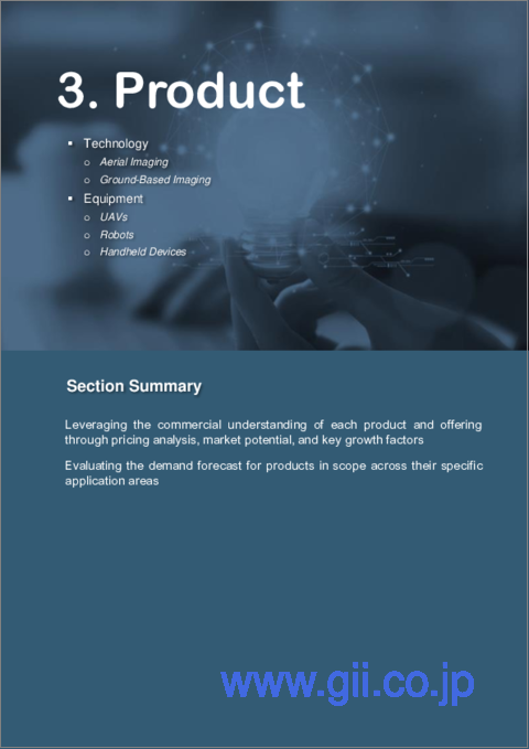
第3章 製品
- 世界の精密農業向け画像技術市場:技術別
- 航空画像
- 地上画像
- 世界の精密農業向け画像技術市場:機器別
- UAV
- ロボット
- ハンドヘルド機器
- バリューチェーン/サプライチェーン分析
- 特許分析
第4章 地域
- 北米
- 南米
- 欧州
- 英国
- 中東・アフリカ
- 中国
- アジア太平洋
第5章 市場:競合ベンチマーキング・企業プロファイル
- 競合ベンチマーキング
- 競合マトリックス
- 市場シェア分析
- 企業プロファイル
第6章 調査手法
List of Figures
- Figure 1: Scope Inclusion and Exclusion
- Figure 2: Scope Definition
- Figure 3: Imaging Technologies' Potential in Addressing Challenges within Agriculture
- Figure 4: Global Imaging Technologies for Precision Agriculture Market, $Million, 2022-2028
- Figure 5: Market Dynamics for Global Imaging Technologies for Precision Agriculture Market
- Figure 6: Global Imaging Technologies for Precision Agriculture Market (by Application), $Million, 2022-2028
- Figure 7: Global Imaging Technologies for Precision Agriculture Market (by Crop Monitoring), $Million, 2022-2028
- Figure 8: Global Imaging Technologies for Precision Agriculture Market (by Technology), $Million, 2022-2028
- Figure 9: Global Imaging Technologies for Precision Agriculture Market (by Equipment), $Million, 2022-2028
- Figure 10: Global Imaging Technologies for Precision Agriculture Market (by Region), 2022
- Figure 11: Efficient Utilization of Resources with the Help of Imaging Technologies
- Figure 12: Utilizing Satellite Data for Soil Moisture Monitoring and Crop Management
- Figure 13: Drone, Aircraft, and Satellite Imagery Usage in the U.S. (by Crop)
- Figure 14: Internet Penetration % of Total Population by Region
- Figure 15: Global Precision Agriculture Market Revenue, $Million, 2022-2028
- Figure 16: Share of Key Market Strategies and Developments, 2019-2023
- Figure 17: Product Development and Innovations (by Company)
- Figure 18: Partnerships, collaborations, Joint Ventures, and Alliances
- Figure 19: Global Imaging technologies for Precision Agriculture Market, Investment and Funding, $Million, January 2018-June 2023
- Figure 20: Global Imaging Technologies for Precision Agriculture Market, Share of Top Investors, $Million, January 2018-June 2023
- Figure 21: Imaging Technologies for Precision Agriculture Market, Funding Analysis (by Country)
- Figure 22: Patents Filed or Granted Analyzed for Global Precision Agriculture Market, January 2018-December 2022
- Figure 23: Patents Analysis (by Organization), January 2018-December 2022
- Figure 24: Patents Analysis (by Patent Office), January 2018-December 2022
- Figure 25: Competitive Market: High and Low Matrix for Imaging Technologies for Precision Agriculture Market
- Figure 26: Market Share Analysis of Imaging Technologies for Precision Agriculture Market, 2022
- Figure 27: GeoPard Agriculture: Product and Customer Portfolio Analysis
- Figure 28: Ceres Imaging: Product and Customer Portfolio Analysis
- Figure 29: Syngenta: Product and Customer Portfolio Analysis
- Figure 30: AgEagle Aerial Systems Inc.: Product and Customer Portfolio Analysis
- Figure 31: Taranis: Product and Customer Portfolio Analysis
- Figure 32: DJI: Product and Customer Portfolio Analysis
- Figure 33: Trimble Inc.: Product and Customer Portfolio Analysis
- Figure 34: Resonon: Product and Customer Portfolio Analysis
- Figure 35: Specim: Product and Customer Portfolio Analysis
- Figure 36: Planet Labs PBC: Product Portfolio
- Figure 37: Agricolus: Product and Customer Portfolio Analysis
- Figure 38: Data Triangulation
- Figure 39: Top-Down and Bottom-Up Approach
- Figure 40: Assumptions and Limitations
List of Tables
- Table 1: Consortiums and Associations
- Table 2: Regulatory Bodies
- Table 3: Government Initiatives and Impacts
- Table 4: Top Funding Deals by the Start-Ups and Investors
- Table 5: Global Imaging Technologies for Precision Agriculture Market (by Application), $Million, 2022-2028
- Table 6: Global Imaging Technologies for Precision Agriculture Market (by Crop Monitoring), $Million, 2022-2028
- Table 7: Global Imaging Technologies for Precision Agriculture Market (by Technology), $Million, 2022-2028
- Table 8: Global Imaging Technologies for Precision Agriculture Market (by Equipment), $Million, 2022-2028
- Table 9: Global Imaging Technologies for Precision Agriculture Market (by Equipment), Units, 2022-2028
- Table 10: Global Imaging Technologies for Precision Agriculture Market (by Region), $Million, 2022-2028
- Table 11: FIXAR-AERO, LLC: Product and Customer Portfolio Analysis
“Global Imaging Technologies for Precision Agriculture Market to Reach $1,690.6 Million by 2028.”
Introduction to Imaging Technologies for Precision Agriculture
The global imaging technologies for precision agriculture market size was $885.0 million in 2022, and with a CAGR of 11.27%, it is expected to reach $1,690.6 million by 2028. The adoption of imaging technologies in agriculture is driven by multiple factors. Firstly, the need for precision and efficiency pushes farmers to optimize their agricultural practices by utilizing data-driven insights from imaging technologies, enabling them to identify crop health issues and apply targeted treatments. Secondly, these technologies offer cost savings by reducing excessive resource usage, minimizing chemical inputs, and lowering labor costs through automation. Thirdly, imaging technologies contribute to environmental benefits by promoting sustainable farming practices, reducing chemical runoff, and preserving natural resources. Lastly, in the face of climate change, these technologies aid in continuous crop monitoring, assisting farmers in adapting to changing conditions and ensuring food security. Overall, these factors combine to accelerate the adoption of imaging technologies in precision agriculture.
| KEY MARKET STATISTICS | |
|---|---|
| Forecast Period | 2023 - 2028 |
| 2023 Evaluation | $991.2 Million |
| 2028 Forecast | $1,690.6 Million |
| CAGR | 11.27% |
Market Introduction
Imaging technologies in precision agriculture involve the use of various sensors and cameras to capture detailed information about crops, soil, and other environmental factors. These technologies enable farmers and agronomists to monitor and analyze crop health, detect diseases, assess nutrient levels, and identify pest infestations with a high level of accuracy. Aerial and ground-based imaging solutions are used for crop monitoring, soil mapping, and climate monitoring.
Impact
Increased Productivity and Yield: Imaging technologies such as drone-based imaging and satellite-based sensors provide real-time insights into crop health and growth patterns. Farmers can detect early signs of diseases, nutrient deficiencies, or pest infestations, enabling them to take timely action. By addressing these issues promptly, they can improve crop health and achieve higher yields, maximizing their overall productivity and profitability.
Resource Efficiency and Cost Savings: Through imaging technologies, farmers can map variations in soil health and moisture levels across their fields. This data helps them tailor irrigation and fertilizer applications precisely to meet crop requirements, reducing waste and optimizing resource utilization. By using inputs more efficiently, farmers can save costs on excess chemicals and fertilizers, contributing to higher profitability and sustainable agricultural practices.
Sustainability and Environmental Benefits: Imaging technologies promote sustainable farming practices by minimizing the use of agrochemicals. With the targeted application of fertilizers and pesticides, there is less runoff into water bodies, reducing water pollution. Additionally, optimizing irrigation lowers water consumption, conserving this valuable resource. These practices contribute to environmental preservation, soil health improvement, and a reduction in the overall ecological footprint of agriculture.
Data-Driven Decision-Making and Precision Agriculture: The data collected through imaging technologies provides valuable insights into crop performance and field variability. Farmers can analyze this data to make informed decisions on planting, harvesting, and resource allocation. Precision agriculture techniques, enabled by imaging technologies, involve prescription mapping, variable rate technology, and automated machinery. These strategies streamline farming operations, enhance efficiency, and ultimately lead to more sustainable and productive agricultural systems.
Market Segmentation:
Segmentation 1: by Application
- Crop Monitoring
- Soil Mapping
- Climate Monitoring
Crop Monitoring to be the Largest Application Segment for Imaging Technologies over the Forecast Period
Crop monitoring was the largest application segment for imaging technologies and generated revenue of $631.0 million in 2022 and is expected to reach $1,238.8 million. This trend can be attributed to the rising focus of the growers on crop health and the need to adopt precision agriculture practices. Imaging technologies provide real-time insights into pest and disease detection, enabling targeted interventions and cost-effective solutions for farmers. Technological advancements, such as drones and hyperspectral imaging, have made these tools more accessible and data-driven, empowering farmers to make informed decisions. Moreover, the unpredictable impacts of climate change on agriculture have emphasized the need for continuous crop monitoring, further fueling the adoption of imaging technologies in the agricultural sector. Government support and initiatives aimed at promoting sustainable farming practices have also contributed to this growing demand.
Segmentation 2: by Crop Monitoring
- Nutrient Analysis
- Yield Prediction and Estimation
- Pest and Disease Detection
- Weed Detection
Imaging Technology in Crop Monitoring Being Used for Pest and Disease Detection
Imaging technology plays a pivotal role in crop monitoring, with its primary application being pest and disease detection. By harnessing the power of advanced sensors and imaging techniques, farmers can swiftly and accurately identify early signs of infestations or diseases in their crops. This timely detection empowers them to implement precise interventions, such as targeted spraying or localized treatments, minimizing the spread of pests and diseases and optimizing the use of agrochemicals. As a result, imaging technology not only enhances crop health and yields but also promotes sustainable and eco-friendly farming practices by reducing unnecessary chemical applications.
Segmentation 3: by Technology
- Aerial Imaging
- Ground-based Imaging
Aerial Imaging Technologies to Remain the Largest Technology Segment during the Forecast Period
Aerial imaging technology has emerged as one of the largest segments in the precision agriculture imaging technologies market, generating revenues of $610.5 million in 2022 and projected to reach $1,197.5 million by 2028. Aerial imaging offers the advantage of wide area coverage. Drones or manned aircraft equipped with imaging sensors can swiftly survey vast agricultural landscapes, providing farmers with a comprehensive view of their fields. This capability enables efficient monitoring and timely detection of crop health issues, pest infestations, or nutrient deficiencies across large areas, which would be challenging to achieve through ground-based methods.
Technology has witnessed significant advancements in recent years, leading to the capture of high-resolution imagery. High-resolution aerial images deliver detailed insights into crop conditions, soil variability, and other critical parameters. This granular data empowers farmers to make precise decisions, optimize resource allocation, and implement targeted interventions to improve overall farm productivity.
Moreover, aerial imaging has become increasingly cost-effective compared to traditional approaches such as manned flights or satellite services. The advent of sophisticated yet affordable drone technology has democratized access to aerial imaging for farmers of all scales. This accessibility has led to wider adoption of the technology across diverse agricultural operations.
Segmentation 4: by Region
- North America - U.S., Canada, and Mexico
- Europe - Germany, France, Italy, Spain, Netherlands, Belgium, Switzerland, and Rest-of-Europe
- China
- U.K.
- Asia-Pacific - Japan, India, Australia and New Zealand, and Rest-of-Asia-Pacific
- South America - Argentina, Brazil, and Rest-of-South America
- Middle East and Africa - Israel, South Africa, Turkey
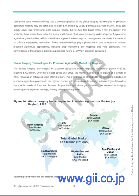
Imaging technologies for precision agriculture demand is expected to experience the highest growth at 12.85% CAGR during 2023-2028 in the Asia-Pacific region due to factors such as increasing adoption of smart farming practices, rising awareness about the benefits of precision agriculture, government initiatives promoting agricultural technology, and the need to address food security challenges in the region. These factors are encouraging farmers and agricultural stakeholders in the Asia-Pacific to invest in advanced imaging technologies for enhanced crop monitoring and management, leading to significant market expansion.
North America and Europe are expected to dominate the imaging technologies for precision agriculture market during the forecast period. This is attributed to the high adoption rate of advanced agricultural technologies, government support for precision farming practices, well-established infrastructure, and the presence of major agribusinesses investing in precision agriculture solutions. Additionally, the growing focus on sustainable farming, efficient resource utilization, and increasing demand for high-quality agricultural produce is further expected to drive the market's growth in these regions.
Recent Developments in the Global Imaging Technologies for Precision Agriculture Market
- In December 2022, Lindsay Corporation, a global manufacturer and distributor of irrigation equipment, announced a strategic partnership with Ceres Imaging. The collaboration would integrate Ceres Imaging's high-resolution imagery and analytics into Lindsay's FieldNET platform, enhancing remote monitoring, control, and analysis of irrigation.
- In July 2021, Resonon launched the Pika UV hyperspectral camera. This unique instrument scans ultraviolet light in the 330-800 nm spectral range, making it the only commercially available ultraviolet hyperspectral imaging device.
- In January 2021, AgEagle Aerial Systems Inc. announced its agreement to acquire MicaSense, Inc. from Parrot in a deal valued at $23 million. AgEagle is a prominent provider of drone systems and solutions, and the acquisition of MicaSense, a company specializing in multispectral imaging solutions for agriculture, would further enhance AgEagle's capabilities in the agricultural drone market.
Demand - Drivers and Limitations
Market Demand Drivers: Global Imaging Technologies for Precision Agriculture Market
- Efficient Resource Management
- Need for Data-Driven Decision Making
- Climate Change and Extreme Weather Events
Market Challenges: Global Imaging Technologies for Precision Agriculture Market
- Adoption and Awareness
- Infrastructure and Connectivity
Market Opportunities: Global Imaging Technologies for Precision Agriculture Market
- Growing Precision Agriculture Adoption
- Customization and Tailored Solutions
How Can This Report Add Value to an Organization?
Market Insight: The report on the global imaging technologies for precision agriculture market offers valuable insights into the industry landscape, market trends, and growth drivers. It provides a comprehensive understanding of imaging equipment, including UAVs, robots, and handheld devices. Additionally, it covers imaging technologies used in the industry, such as aerial imaging and ground-based imaging. Moreover, the report discusses imaging technologies and their applications, such as crop monitoring, soil mapping, and climate monitoring. This information allows organizations to gain a deeper understanding of market dynamics and identify potential opportunities for their products and applications.
Product/Innovation Strategy: By highlighting the different imaging technologies for precision agriculture, the report enables organizations to assess market demand and adoption. It provides insights into advancements and innovations in the industry, helping organizations align their product development strategies to meet market requirements. Furthermore, the report explores diverse imaging technologies and applications, assisting organizations in identifying areas for product diversification and expansion.
Growth/Marketing Strategy: The report on imaging technologies for precision agriculture empowers organizations to gauge market demand and adoption by showcasing various imaging solutions. It offers valuable insights into industry advancements and innovations, enabling companies to align their product development strategies with market needs. Additionally, the report explores the diverse applications of imaging technologies, helping organizations identify opportunities for product diversification and expansion in the precision agriculture market.
Competitive Strategy: The report profiles major players in the imaging technologies for precision agriculture market, including aerial and ground-based imaging technology providers. It evaluates the competitive landscape, product offerings, and strategic approaches. Organizations can leverage this valuable information to understand their competitors' strengths and weaknesses, identify potential areas for collaboration or partnerships, and strategically position themselves in the market to gain a competitive edge.
Primary Data Sources
The primary sources involve industry experts from the agricultural industry and various stakeholders such as agricultural equipment manufacturers and equipment suppliers, smart farming technology developers, precision agriculture solution providers, and software and platform providers. Respondents such as CEOs, vice presidents, marketing directors, and technology and innovation directors have been interviewed to obtain and verify both qualitative and quantitative aspects of this research study.
The key data points taken from primary sources Include:
- validation and triangulation of all the numbers and graphs
- validation of reports segmentation and key qualitative findings
- understanding the competitive landscape
- validation of the numbers of various markets for market type
- percentage split of individual markets for geographical analysis
Secondary Data Sources
This research study involves the usage of extensive secondary research, directories, company websites, and annual reports. It also makes use of databases, such as ITU, Hoovers, Bloomberg, Businessweek, and Factiva, to collect useful and effective information for an extensive, technical, market-oriented, and commercial study of the global market. In addition to the aforementioned data sources, the study has been undertaken with the help of other data sources and websites, such as the United States Department of Agriculture, International Society of Precision Agriculture, World Bank, World Economic Forum, and Food and Agriculture Organization.
Secondary research was done in order to obtain crucial information about the industry's value chain, revenue models, the market's monetary chain, the total pool of key players, and the current and potential use cases and applications.
The key data points taken from secondary research include:
- segmentations and percentage shares
- data for market value
- key industry trends of the top players of the market
- qualitative insights into various aspects of the market, key trends, and emerging areas of innovation
- quantitative data for mathematical and statistical calculations
Key Market Players and Competition Synopsis
The companies that are profiled have been selected based on inputs gathered from primary experts and analyzing company coverage, product portfolio, and market penetration.
The global imaging technologies for precision agriculture market is highly fragmented, with several large multinationals and many start-ups operating in it. In the global imaging technologies for precision agriculture market, as of 2022, the top 5 companies hold a combined market share of around 30%, with DJI emerging as the leader. The remaining market share of over 70% is distributed among numerous other players, including Gamaya, Resonon, Specim, Agricolus, FIXAR-AERO LLC, and GeoPard Agriculture, among others. This fragmented landscape reflects multiple competitors offering solutions to meet industry needs. Stakeholders must closely monitor market dynamics and technological advancements to stay competitive in this dynamic sector.
Key Companies Profiled:
|
|
Table of Contents
1 Markets
- 1.1 Industry Outlook
- 1.1.1 Ecosystem/Ongoing Programs
- 1.1.1.1 Consortiums and Associations
- 1.1.1.2 Regulatory Bodies
- 1.1.1.3 Government Initiatives and Impacts
- 1.1.2 Business Dynamics
- 1.1.2.1 Efficient Resource Management
- 1.1.2.2 Need for Data-Driven Decision Making
- 1.1.2.3 Climate Change and Extreme Weather Events
- 1.1.3 Business Challenges
- 1.1.3.1 Adoption and Awareness
- 1.1.3.2 Infrastructure and Connectivity
- 1.1.4 Business Opportunities
- 1.1.4.1 Growing Precision Agriculture Adoption
- 1.1.4.2 Customization and Tailored Solutions
- 1.1.5 Market Strategies and Developments
- 1.1.1 Ecosystem/Ongoing Programs
- 1.2 Start-up Landscape
- 1.2.1 Funding Analysis
- 1.2.1.1 Total Investment and Number of Funding Deals
- 1.2.1.2 Top Investors
- 1.2.1.3 Funding Analysis (by Country)
- 1.2.1.4 Top Funding Deals by the Start-Ups and Investors
- 1.2.1 Funding Analysis
2 Application
- 2.1 Global Imaging Technologies for Precision Agriculture Market (by Application)
- 2.1.1 Crop Monitoring
- 2.1.1.1 Nutrient Analysis
- 2.1.1.2 Yield Prediction and Estimation
- 2.1.1.3 Weed Detection
- 2.1.1.4 Pest and Disease Detection
- 2.1.2 Soil Mapping
- 2.1.3 Climate Monitoring
- 2.1.1 Crop Monitoring
3 Products
- 3.1 Global Imaging Technologies for Precision Agriculture Market (by Technology)
- 3.1.1 Aerial Imaging
- 3.1.2 Ground-Based Imaging
- 3.2 Global Imaging Technologies for Precision Agriculture Market (by Equipment)
- 3.2.1 UAVs
- 3.2.2 Robots
- 3.2.3 Handheld Equipment
- 3.3 Value Chain/Supply Chain Analysis
- 3.4 Patent Analysis
- 3.4.1 Patent Analysis (by Organization)
- 3.4.2 Patent Analysis (by Patent Office)
4 Region
- 4.1 North America
- 4.1.1 North America (by Country)
- 4.1.1.1 U.S.
- 4.1.1.2 Canada
- 4.1.1.3 Mexico
- 4.1.1 North America (by Country)
- 4.2 South America
- 4.2.1 South America (by Country)
- 4.2.1.1 Brazil
- 4.2.1.2 Argentina
- 4.2.1.3 Rest-of-South America
- 4.2.1 South America (by Country)
- 4.3 Europe
- 4.3.1 Europe (by Country)
- 4.3.1.1 Germany
- 4.3.1.2 France
- 4.3.1.3 Spain
- 4.3.1.4 Italy
- 4.3.1.5 Netherlands
- 4.3.1.6 Switzerland
- 4.3.1.7 Belgium
- 4.3.1.8 Rest-of-Europe
- 4.3.1 Europe (by Country)
- 4.4 U.K.
- 4.5 Middle East and Africa
- 4.5.1 Middle East and Africa (by Country)
- 4.5.1.1 South Africa
- 4.5.1.2 Israel
- 4.5.1.3 Turkey
- 4.5.1 Middle East and Africa (by Country)
- 4.6 China
- 4.6.1 Asia Pacific (by Country)
- 4.6.1.1 Japan
- 4.6.1.2 Australia and New Zealand
- 4.6.1.3 India
- 4.6.1.4 Rest-of-APAC
- 4.6.1 Asia Pacific (by Country)
5 Markets - Competitive Benchmarking & Company Profiles
- 5.1 Competitive Benchmarking
- 5.1.1 Competitive Position Matrix
- 5.1.2 Market Share Analysis
- 5.1.3 Company Profile
- 5.1.3.1 GeoPard Agriculture
- 5.1.3.1.1 Company Overview
- 5.1.3.1.2 Product and Customer Portfolio Analysis
- 5.1.3.2 Ceres Imaging
- 5.1.3.2.1 Company Overview
- 5.1.3.2.2 Product and Customer Portfolio Analysis
- 5.1.3.3 Syngenta
- 5.1.3.3.1 Company Overview
- 5.1.3.3.2 Product and Customer Portfolio Analysis
- 5.1.3.4 AgEagle Aerial Systems Inc.
- 5.1.3.4.1 Company Overview
- 5.1.3.4.2 Product and Customer Portfolio Analysis
- 5.1.3.5 Taranis
- 5.1.3.5.1 Company Overview
- 5.1.3.5.2 Product and Customer Portfolio Analysis
- 5.1.3.6 DJI
- 5.1.3.6.1 Company Overview
- 5.1.3.6.2 Product and Customer Portfolio Analysis
- 5.1.3.7 Trimble Inc.
- 5.1.3.7.1 Company Overview
- 5.1.3.7.2 Product and Customer Portfolio Analysis
- 5.1.3.8 Resonon
- 5.1.3.8.1 Company Overview
- 5.1.3.8.2 Product and Customer Portfolio Analysis
- 5.1.3.9 Specim (A Konica Minolta Company)
- 5.1.3.9.1 Company Overview
- 5.1.3.9.2 Product and Customer Portfolio Analysis
- 5.1.3.10 Planet Labs PBC
- 5.1.3.10.1 Company Overview
- 5.1.3.10.2 Product Portfolio
- 5.1.3.11 Agricolus
- 5.1.3.11.1 Company Overview
- 5.1.3.11.2 Product and Customer Portfolio Analysis
- 5.1.3.12 FIXAR-AERO, LLC
- 5.1.3.12.1 Company Overview
- 5.1.3.12.2 Product and Customer Portfolio Analysis
- 5.1.3.1 GeoPard Agriculture
6 Research Methodology
- 6.1 Data Sources
- 6.1.1 Primary Data Sources
- 6.1.2 Secondary Data Sources
- 6.1.3 Data Triangulation
- 6.2 Market Estimation and Forecast