|
|
市場調査レポート
商品コード
1447043
地理空間イメージングの2030年までの市場予測: タイプ、プラットフォーム、アプリケーション、エンドユーザー、地域別の世界分析Geospatial Imaging Market Forecasts to 2030 - Global Analysis By Type (Aerial Imaging, Satellite Imaging, Real-time Imaging, Mapping Software, GIS Software, 2D and 3D Imaging and Other Types), Platform, Application, End User and By Geography |
||||||
|
|||||||
カスタマイズ可能
|
|||||||
| 地理空間イメージングの2030年までの市場予測: タイプ、プラットフォーム、アプリケーション、エンドユーザー、地域別の世界分析 |
|
出版日: 2024年03月03日
発行: Stratistics Market Research Consulting
ページ情報: 英文 200+ Pages
納期: 2~3営業日
|

全表示
- 概要
- 図表
- 目次
Stratistics MRCによると、世界の地理空間イメージング市場は2023年に20億米ドルを占め、予測期間中のCAGRは18.4%で成長し、2030年には65億米ドルに達する見込みです。
地理空間イメージングは、リモートセンシング、GIS、GPS、LiDARなどの技術を採用して空間データを取得、分析、可視化し、地表の詳細な洞察を提供します。農業、都市計画、災害管理など多様な分野で活用され、正確なマッピング、環境モニタリング、意思決定を可能にします。衛星、航空機、地上のセンサーがデータを収集し、高解像度の画像や3Dモデルを作成します。地理空間イメージングは、情報に基づいて意思決定を行い、資源を管理し、分析・視覚化を改善するために空間データを活用して複雑な課題に対処するために不可欠です。
BloombergNEFによると、LiDARを搭載した合計21の乗用車モデルが世界の17の自動車メーカーから発表され、生産中または近日発売される予定です。
高解像度衛星画像の利用可能性の増加
高解像度の衛星画像を利用できるようになったことで、より鮮明で詳細な画像を提供する衛星機能が強化され、農業、都市計画、災害対応などの産業に力を与えています。この利用しやすさが、正確な地図作成、資源管理、インフラ整備を促進します。企業や政府機関が意思決定のために正確な地理空間データにますます依存するようになるにつれ、高解像度衛星画像の需要は急増し続け、地理空間イメージング市場を新たな高みへと押し上げています。
規制と法的問題
プライバシーやデータセキュリティに対する社会的な懸念は、地理空間データの収集や利用を制限する可能性があります。各国政府はデータの収集、保存、共有に関してより厳しい規制を導入しており、企業にとって複雑な状況を生み出しています。さらに、データライセンスや知的財産権における複雑さや、高解像度の衛星画像へのアクセスを制限する政府の規制が、潜在的なアプリケーションに影響を与え、市場の成長を妨げています。
ロケーション・インテリジェンスへの需要の高まりとクラウド・コンピューティングの採用
より鮮明で詳細な画像を提供する衛星機能の強化は、農業、都市計画、災害対応などの産業に力を与えます。このアクセシビリティは、正確な地図作成、資源管理、インフラ整備を促進します。企業や政府機関が意思決定のために正確な地理空間データにますます依存するようになるにつれ、高解像度の衛星画像に対する需要は急増し続け、地理空間イメージング市場を新たな高みへと押し上げています。
プライバシー問題に対する監視の強化
位置情報データの収集と利用に対する懸念の高まりにより、規制当局の監視が強化され、コンプライアンス要件が厳しくなっています。これは、特に都市計画や商業用途において、地理空間情報のシームレスな取得と普及を妨げる可能性があります。さらに、この市場で事業を展開する企業は、複雑なプライバシー規制を乗り越えなければならないため、データ取得の範囲が制限され、地理空間イメージングソリューションの精度に影響を与える可能性があります。
COVID-19の影響
感染症の追跡、社会的距離のモニタリング、封鎖区域の管理などの用途で需要が急増。都市計画やインフラ管理などの分野では、復旧作業の戦略立案に地理空間データが活用されました。しかし、衛星打ち上げとデータ収集の中断、予算削減が市場の成長を妨げました。全体として、パンデミックは危機対応への地理空間技術の採用を加速させ、様々な分野での可能性を浮き彫りにしました。
リアルタイムイメージング分野は予測期間中最大になる見込み
ドローン、衛星、センサーなどの先端技術の統合により、即時かつ正確な地理空間情報の検索が可能になります。このリアルタイム機能は、農業、都市計画、災害管理などの分野における意思決定プロセスを大幅に改善します。このように、ダイナミックな環境を監視・分析するための最新データへの需要が、地理空間イメージング市場を前進させ、イノベーションと効率性を促進しています。
予測期間中にCAGRが最も高くなると予想されるのは車載機器セグメント
高度なセンサーとイメージング技術を搭載したこれらのデバイスは、ナビゲーション、マッピング、都市計画のためのリアルタイムの地理空間情報を提供します。これらのデバイスが車両にシームレスに統合されたことで、データ収集が迅速化され、精度が向上し、地理空間イメージングの用途が拡大しました。したがって、車両が地理空間データ収集にますます役立つようになるにつれ、市場は継続的な拡大と技術進歩の態勢を整えています。
最大のシェアを占める地域
アジア太平洋地域は、急速な都市化、インフラ整備、政府の取り組みにより、予測期間中に最大の市場シェアを占めると予測されています。中国、インド、日本のような国々は、都市計画、農業、災害管理のために地理空間イメージングを採用しています。さらに、5Gインフラの拡大は、地理空間アプリケーションのデータ接続をさらに強化し、この地域の市場を牽引しています。
CAGRが最も高い地域:
北米は、主要な市場プレイヤーの存在感が強く、都市計画、農業、防衛などのアプリケーションで大きな成長を遂げているため、予測期間中、CAGRが最も高くなると予測されています。さらに、高解像度の衛星画像高度なGIS技術と地理空間データとIoTの統合が市場の拡大に寄与しています。
無料のカスタマイズサービス
本レポートをご購読のお客様には、以下の無料カスタマイズオプションのいずれかをご利用いただけます:
- 企業プロファイル
- 追加市場プレイヤーの包括的プロファイリング(3社まで)
- 主要企業のSWOT分析(3社まで)
- 地域セグメンテーション
- 顧客の関心に応じた主要国の市場推計・予測・CAGR(注:フィージビリティチェックによる)
- 競合ベンチマーキング
- 製品ポートフォリオ、地理的プレゼンス、戦略的提携に基づく主要企業のベンチマーキング
目次
第1章 エグゼクティブサマリー
第2章 序文
- 概要
- ステークホルダー
- 調査範囲
- 調査手法
- データマイニング
- データ分析
- データ検証
- 調査アプローチ
- 調査ソース
- 1次調査ソース
- 2次調査ソース
- 前提条件
第3章 市場動向分析
- 促進要因
- 抑制要因
- 機会
- 脅威
- アプリケーション分析
- エンドユーザー分析
- 新興市場
- 新型コロナウイルス感染症(COVID-19)の影響
第4章 ポーターのファイブフォース分析
- 供給企業の交渉力
- 買い手の交渉力
- 代替品の脅威
- 新規参入業者の脅威
- 競争企業間の敵対関係
第5章 世界の地理空間イメージング市場:タイプ別
- 航空写真撮影
- 衛星画像処理
- リアルタイムイメージング
- 地図作成ソフトウェア
- GISソフトウェア
- 2Dおよび3Dイメージング
- その他のタイプ
第6章 世界の地理空間イメージング市場:プラットフォーム別
- 車載装置
- ドローン
- 携帯
- バックパック
- その他のプラットフォーム
第7章 世界の地理空間イメージング市場:アプリケーション別
- 災害管理と緊急対応
- 測量と地図作成
- 天然資源管理
- 都市計画と開発
- 輸送と物流
- 環境モニタリング
- その他のアプリケーション
第8章 世界の地理空間イメージング市場:エンドユーザー別
- 政府と防衛
- 電気通信
- ヘルスケア
- 教育と調査
- インフラストラクチャーと建設
- 農業
- その他のエンドユーザー
第9章 世界の地理空間イメージング市場:地域別
- 北米
- 米国
- カナダ
- メキシコ
- 欧州
- ドイツ
- 英国
- イタリア
- フランス
- スペイン
- その他欧州
- アジア太平洋地域
- 日本
- 中国
- インド
- オーストラリア
- ニュージーランド
- 韓国
- その他アジア太平洋地域
- 南米
- アルゼンチン
- ブラジル
- チリ
- その他南米
- 中東とアフリカ
- サウジアラビア
- アラブ首長国連邦
- カタール
- 南アフリカ
- その他中東とアフリカ
第10章 主な発展
- 契約、パートナーシップ、コラボレーション、合弁事業
- 買収と合併
- 新製品の発売
- 事業拡大
- その他の主要戦略
第11章 企業プロファイル
- ESRI, Inc.
- Fugro N.V.
- Hexagon AB
- Surdex Corporation
- Trimble, Inc.
- Woolpert Inc
- Pasco Corporation
- NV5 Global, Inc.
- Asia Air Survey Co., Ltd
- Cyient Limited
- The Sanborn Map Company
- Harris Geospatial Solutions
- BlackSky Global
- Teledyne Technologies
- Planet Labs
- Rolta India Ltd.
- Google Earth
- DigitalGlobe
List of Tables
- Table 1 Global Geospatial Imaging Market Outlook, By Region (2021-2030) ($MN)
- Table 2 Global Geospatial Imaging Market Outlook, By Type (2021-2030) ($MN)
- Table 3 Global Geospatial Imaging Market Outlook, By Aerial Imaging (2021-2030) ($MN)
- Table 4 Global Geospatial Imaging Market Outlook, By Satellite Imaging (2021-2030) ($MN)
- Table 5 Global Geospatial Imaging Market Outlook, By Real-time Imaging (2021-2030) ($MN)
- Table 6 Global Geospatial Imaging Market Outlook, By Mapping Software (2021-2030) ($MN)
- Table 7 Global Geospatial Imaging Market Outlook, By GIS Software (2021-2030) ($MN)
- Table 8 Global Geospatial Imaging Market Outlook, By 2D and 3D Imaging (2021-2030) ($MN)
- Table 9 Global Geospatial Imaging Market Outlook, By Other Types (2021-2030) ($MN)
- Table 10 Global Geospatial Imaging Market Outlook, By Platform (2021-2030) ($MN)
- Table 11 Global Geospatial Imaging Market Outlook, By Vehicle Mounted Device (2021-2030) ($MN)
- Table 12 Global Geospatial Imaging Market Outlook, By Drones (2021-2030) ($MN)
- Table 13 Global Geospatial Imaging Market Outlook, By Mobile (2021-2030) ($MN)
- Table 14 Global Geospatial Imaging Market Outlook, By Backpack (2021-2030) ($MN)
- Table 15 Global Geospatial Imaging Market Outlook, By Other Platforms (2021-2030) ($MN)
- Table 16 Global Geospatial Imaging Market Outlook, By Application (2021-2030) ($MN)
- Table 17 Global Geospatial Imaging Market Outlook, By Disaster Management & Emergency Response (2021-2030) ($MN)
- Table 18 Global Geospatial Imaging Market Outlook, By Surveying & Mapping (2021-2030) ($MN)
- Table 19 Global Geospatial Imaging Market Outlook, By Natural Resource Management (2021-2030) ($MN)
- Table 20 Global Geospatial Imaging Market Outlook, By Urban Planning & Development (2021-2030) ($MN)
- Table 21 Global Geospatial Imaging Market Outlook, By Transportation & Logistics (2021-2030) ($MN)
- Table 22 Global Geospatial Imaging Market Outlook, By Environmental Monitoring (2021-2030) ($MN)
- Table 23 Global Geospatial Imaging Market Outlook, By Other Applications (2021-2030) ($MN)
- Table 24 Global Geospatial Imaging Market Outlook, By End User (2021-2030) ($MN)
- Table 25 Global Geospatial Imaging Market Outlook, By Government and Defense (2021-2030) ($MN)
- Table 26 Global Geospatial Imaging Market Outlook, By Telecommunications (2021-2030) ($MN)
- Table 27 Global Geospatial Imaging Market Outlook, By Healthcare (2021-2030) ($MN)
- Table 28 Global Geospatial Imaging Market Outlook, By Education & Research (2021-2030) ($MN)
- Table 29 Global Geospatial Imaging Market Outlook, By Infrastructure & Construction (2021-2030) ($MN)
- Table 30 Global Geospatial Imaging Market Outlook, By Agriculture (2021-2030) ($MN)
- Table 31 Global Geospatial Imaging Market Outlook, By Other End Users (2021-2030) ($MN)
Note: Tables for North America, Europe, APAC, South America, and Middle East & Africa Regions are also represented in the same manner as above.
According to Stratistics MRC, the Global Geospatial Imaging Market is accounted for $2.0 billion in 2023 and is expected to reach $6.5 billion by 2030 growing at a CAGR of 18.4% during the forecast period. Geospatial imaging employs technologies like remote sensing, GIS, GPS, and LiDAR to capture, analyze, and visualize spatial data, providing detailed insights into Earth's surface. Utilized in diverse fields such as agriculture, urban planning, and disaster management, it enables precise mapping, environmental monitoring, and decision-making. Satellites, aircraft, and ground-based sensors collect data, creating high-resolution images and 3D models. Geospatial imaging is essential for informed decision-making, resource management, and addressing complex challenges by harnessing spatial data for improved analysis and visualization.
According to BloombergNEF, a total of 21 passenger car models equipped with LiDAR were announced by 17 automakers across the world, either in production or set to be released soon which will increase the demand for Geospatial Imaging Market
Market Dynamics:
Driver:
Increasing availability of high-resolution satellite imagery
The increasing availability of high-resolution satellite imagery, enhanced satellite capabilities, offering sharper and more detailed images, empower industries such as agriculture, urban planning, and disaster response. This accessibility fosters precise mapping, resource management, and infrastructure development. As businesses and government entities increasingly rely on accurate geospatial data for decision-making, the demand for high-resolution satellite imagery continues to surge, propelling the Geospatial Imaging Market to new heights.
Restraint:
Regulations and legal issues
Public concerns about privacy and data security can limit the collection and use of geospatial data. Governments are implementing stricter regulations on data collection, storage, and sharing, creating complexities for businesses. Moreover, complexities in data licensing and intellectual property rights and government restrictions limiting access to high-resolution satellite imagery, impacting potential applications are hampering the growth of the market.
Opportunity:
Growing demand for location intelligence and adoption of cloud computing
Enhanced satellite capabilities, offering sharper and more detailed images, empower industries such as agriculture, urban planning, and disaster response. This accessibility fosters precise mapping, resource management, and infrastructure development. As businesses and government entities increasingly rely on accurate geospatial data for decision-making, the demand for high-resolution satellite imagery continues to surge, propelling the Geospatial Imaging Market to new heights.
Threat:
Increasing scrutiny on privacy issues
Heightened concerns about the collection and utilization of location-based data have led to increased regulatory oversight and stricter compliance requirements. This can impede the seamless acquisition and dissemination of geospatial information, particularly in urban planning and commercial applications. Moreover, companies operating in the market must navigate complex privacy regulations, potentially limiting the scope of data acquisition and impacting the precision of geospatial imaging solutions.
Covid-19 Impact
Demand surged for applications like tracking infections, monitoring social distancing, and managing lockdown areas. Sectors like urban planning and infrastructure management utilized geospatial data for strategizing recovery efforts. However, disruptions in satellite launches and data collection, coupled with budget cuts, hampered market growth. Overall, the pandemic accelerated the adoption of geospatial technologies for crisis response and highlighted its potential in various sectors, paving the way for future advancements impeding the market growth.
The real-time imaging segment is expected to be the largest during the forecast period
The real-time imaging segment is estimated to have a lucrative growth, the integration of advanced technologies like drones, satellites, and sensors allows for immediate and accurate geospatial information retrieval. This real-time capability significantly improves decision-making processes in fields such as agriculture, urban planning, and disaster management. Thus the demand for up-to-the-minute data for monitoring and analyzing dynamic environments has propelled the Geospatial Imaging Market forward, fostering innovation and efficiency.
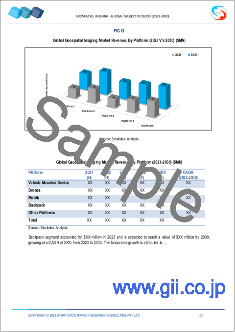
The vehicle mounted device segment is expected to have the highest CAGR during the forecast period
The vehicle mounted device segment is anticipated to witness the highest CAGR growth during the forecast period, owing to these devices, equipped with advanced sensors and imaging technologies, offer real-time geospatial information for navigation, mapping, and urban planning. The seamless integration of these devices into vehicles has expedited data collection, improved accuracy, and expanded the applications of geospatial imaging. Hence, as vehicles become increasingly instrumental in geospatial data gathering, the market is poised for continued expansion and technological advancements.
Region with largest share:
Asia Pacific is projected to hold the largest market share during the forecast period owing to the rapid urbanization, infrastructure development, and government initiatives are propelling the market. Countries like China, India, and Japan are adopting geospatial imaging for urban planning, agriculture, and disaster management. Moreover, the expansion of 5G infrastructure further enhances data connectivity for geospatial applications driving the market in this region.
Region with highest CAGR:
North America is projected to have the highest CAGR over the forecast period, owing to strong presence of key market players, the region experiences substantial growth in applications such as urban planning, agriculture, and defense. Furthermore, high-resolution satellite imagery advanced GIS technologies and the integration of geospatial data with IoT contribute to the market's expansion.
Key players in the market
Some of the key players in the Geospatial Imaging Market include ESRI, Inc., Fugro N.V., Hexagon AB, Surdex Corporation, Trimble, Inc., Woolpert Inc, Pasco Corporation, NV5 Global, Inc., Asia Air Survey Co., Ltd, Cyient Limited, The Sanborn Map Company, Harris Geospatial Solutions, BlackSky Global, Teledyne Technologies, Planet Labs, Fugro N.V., Rolta India Ltd., Google Earth and DigitalGlobe
Key Developments:
In January 2024, Esri Launches Maps.com, a Content Platform for Creators Demonstrating the Power of Maps. The innovative website is set to redefine the way people perceive the power of cartography and data visualization.
In January 2024, Esri Partners with TechSoup, Providing Nonprofit Organizations Easier Access to GIS Technology. To further support the nonprofit sector, Esri, the global leader in GIS, has partnered with TechSoup to make the purchase of Esri software simpler for 501(c)(3) nonprofit organizations.
In February 2023, Fugro expands geotechnical fleet with purchase of two vessels. The offshore renewable energy market continues to grow rapidly, leading to high demand for Fugro's services and strong backlog growth.
Types Covered:
- Aerial Imaging
- Satellite Imaging
- Real-time Imaging
- Mapping Software
- GIS Software
- 2D and 3D Imaging
- Other Types
Platforms Covered:
- Vehicle Mounted Device
- Drones
- Mobile
- Backpack
- Other Platforms
Applications Covered:
- Disaster Management & Emergency Response
- Surveying & Mapping
- Natural Resource Management
- Urban Planning & Development
- Transportation & Logistics
- Environmental Monitoring
- Other Applications
End Users Covered:
- Government and Defense
- Telecommunications
- Healthcare
- Education & Research
- Infrastructure & Construction
- Agriculture
- Other End Users
Regions Covered:
- North America
- US
- Canada
- Mexico
- Europe
- Germany
- UK
- Italy
- France
- Spain
- Rest of Europe
- Asia Pacific
- Japan
- China
- India
- Australia
- New Zealand
- South Korea
- Rest of Asia Pacific
- South America
- Argentina
- Brazil
- Chile
- Rest of South America
- Middle East & Africa
- Saudi Arabia
- UAE
- Qatar
- South Africa
- Rest of Middle East & Africa
What our report offers:
- Market share assessments for the regional and country-level segments
- Strategic recommendations for the new entrants
- Covers Market data for the years 2021, 2022, 2023, 2026, and 2030
- Market Trends (Drivers, Constraints, Opportunities, Threats, Challenges, Investment Opportunities, and recommendations)
- Strategic recommendations in key business segments based on the market estimations
- Competitive landscaping mapping the key common trends
- Company profiling with detailed strategies, financials, and recent developments
- Supply chain trends mapping the latest technological advancements
Free Customization Offerings:
All the customers of this report will be entitled to receive one of the following free customization options:
- Company Profiling
- Comprehensive profiling of additional market players (up to 3)
- SWOT Analysis of key players (up to 3)
- Regional Segmentation
- Market estimations, Forecasts and CAGR of any prominent country as per the client's interest (Note: Depends on feasibility check)
- Competitive Benchmarking
- Benchmarking of key players based on product portfolio, geographical presence, and strategic alliances
Table of Contents
1 Executive Summary
2 Preface
- 2.1 Abstract
- 2.2 Stake Holders
- 2.3 Research Scope
- 2.4 Research Methodology
- 2.4.1 Data Mining
- 2.4.2 Data Analysis
- 2.4.3 Data Validation
- 2.4.4 Research Approach
- 2.5 Research Sources
- 2.5.1 Primary Research Sources
- 2.5.2 Secondary Research Sources
- 2.5.3 Assumptions
3 Market Trend Analysis
- 3.1 Introduction
- 3.2 Drivers
- 3.3 Restraints
- 3.4 Opportunities
- 3.5 Threats
- 3.6 Application Analysis
- 3.7 End User Analysis
- 3.8 Emerging Markets
- 3.9 Impact of Covid-19
4 Porters Five Force Analysis
- 4.1 Bargaining power of suppliers
- 4.2 Bargaining power of buyers
- 4.3 Threat of substitutes
- 4.4 Threat of new entrants
- 4.5 Competitive rivalry
5 Global Geospatial Imaging Market, By Type
- 5.1 Introduction
- 5.2 Aerial Imaging
- 5.3 Satellite Imaging
- 5.4 Real-time Imaging
- 5.5 Mapping Software
- 5.6 GIS Software
- 5.7 2D and 3D Imaging
- 5.8 Other Types
6 Global Geospatial Imaging Market, By Platform
- 6.1 Introduction
- 6.2 Vehicle Mounted Device
- 6.3 Drones
- 6.4 Mobile
- 6.5 Backpack
- 6.6 Other Platforms
7 Global Geospatial Imaging Market, By Application
- 7.1 Introduction
- 7.2 Disaster Management & Emergency Response
- 7.3 Surveying & Mapping
- 7.4 Natural Resource Management
- 7.5 Urban Planning & Development
- 7.6 Transportation & Logistics
- 7.7 Environmental Monitoring
- 7.8 Other Applications
8 Global Geospatial Imaging Market, By End User
- 8.1 Introduction
- 8.2 Government and Defense
- 8.3 Telecommunications
- 8.4 Healthcare
- 8.5 Education & Research
- 8.6 Infrastructure & Construction
- 8.7 Agriculture
- 8.8 Other End Users
9 Global Geospatial Imaging Market, By Geography
- 9.1 Introduction
- 9.2 North America
- 9.2.1 US
- 9.2.2 Canada
- 9.2.3 Mexico
- 9.3 Europe
- 9.3.1 Germany
- 9.3.2 UK
- 9.3.3 Italy
- 9.3.4 France
- 9.3.5 Spain
- 9.3.6 Rest of Europe
- 9.4 Asia Pacific
- 9.4.1 Japan
- 9.4.2 China
- 9.4.3 India
- 9.4.4 Australia
- 9.4.5 New Zealand
- 9.4.6 South Korea
- 9.4.7 Rest of Asia Pacific
- 9.5 South America
- 9.5.1 Argentina
- 9.5.2 Brazil
- 9.5.3 Chile
- 9.5.4 Rest of South America
- 9.6 Middle East & Africa
- 9.6.1 Saudi Arabia
- 9.6.2 UAE
- 9.6.3 Qatar
- 9.6.4 South Africa
- 9.6.5 Rest of Middle East & Africa
10 Key Developments
- 10.1 Agreements, Partnerships, Collaborations and Joint Ventures
- 10.2 Acquisitions & Mergers
- 10.3 New Product Launch
- 10.4 Expansions
- 10.5 Other Key Strategies
11 Company Profiling
- 11.1 ESRI, Inc.
- 11.2 Fugro N.V.
- 11.3 Hexagon AB
- 11.4 Surdex Corporation
- 11.5 Trimble, Inc.
- 11.6 Woolpert Inc
- 11.7 Pasco Corporation
- 11.8 NV5 Global, Inc.
- 11.9 Asia Air Survey Co., Ltd
- 11.10 Cyient Limited
- 11.11 The Sanborn Map Company
- 11.12 Harris Geospatial Solutions
- 11.13 BlackSky Global
- 11.14 Teledyne Technologies
- 11.15 Planet Labs
- 11.16 Rolta India Ltd.
- 11.17 Google Earth
- 11.18 DigitalGlobe

