|
|
市場調査レポート
商品コード
1209816
衛星データサービス市場の2028年までの予測- 業界別、サービス別、展開別、エンドユーザー別、地域別の世界分析Satellite Data Services Market Forecasts to 2028 - Global Analysis By Vertical, Service, Deployment, End User and Geography |
||||||
|
|
|||||||
|
● お客様のご希望に応じて、既存データの加工や未掲載情報(例:国別セグメント)の追加などの対応が可能です。 詳細はお問い合わせください。 |
|||||||

| 衛星データサービス市場の2028年までの予測- 業界別、サービス別、展開別、エンドユーザー別、地域別の世界分析 |
|
出版日: 2023年01月01日
発行: Stratistics Market Research Consulting
ページ情報: 英文 175+ Pages
納期: 2~3営業日
|
- 全表示
- 概要
- 図表
- 目次
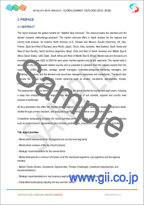
Stratistics MRCによると、衛星データサービスの世界市場は2022年に94億3000万米ドルを占め、2028年には351億5000万米ドルに達し、予測期間中に24.5%のCAGRで成長すると予測されています。
衛星データサービスとは、様々な軌道にある人工衛星から地球に関する情報を収集することです。人工衛星は、地球の表面や天候に関するデータを送信します。衛星データサービスとは、画像衛星を利用して地球や他の惑星の写真を撮影することです。商業衛星画像は、これらの画像を商業目的で使用するもので、環境監視・管理、エネルギー資源の安全保障、国境監視、建築プロジェクトのマッピングなどの用途があります。地球観測は、衛星データ(EO)の主な用途です。地球の表面、気象、化学、生物学的変化に関する情報を発信しています。衛星データは合成開口レーダー(SAR)や実開口レーダー(RAR)などのリモートセンシング技術を利用して生成され、一貫したタイムリーなデータストリームを提供します。
SIPRIによると、2021年の世界の軍事費総額は実質0.7%増加し、2兆1,000億米ドルに達します。
市場力学
促進要因
衛星画像データに対する需要の増加
建設、石油・ガス、農業、鉱業などの業界における衛星画像データの需要の高まりが、市場成長の原動力になると予想されます。建築業界において衛星画像を利用することには、いくつかの利点があります。高解像度の衛星写真を使うことで、インフラプロジェクトはより細部にまでこだわったものになり、衛星データはプランナーやエンジニアにグラフィカルなリファレンスを提供し、その結果、建設の精度を高めることができます。同様に、鉱業分野でも、鉱物採掘のプレフィージビリティやフィージビリティの段階で、その地域の鉱物ポテンシャルに関するデータに基づく情報を得るために、衛星画像を活用することができます。これらの要素により、衛星データサービス市場の拡大が期待されます。
制約
厳しい規制
国内および国際レベルの政府政策は、衛星データサービスのエコシステムとビジネスの進化に直接的または間接的に影響を及ぼします。データ収集、位置情報のプライバシー、知的財産権、地理空間データおよび情報の使用と保存に関する政府の制限は、予測期間を通じて市場成長の妨げとなる可能性があります。さらに、高解像度リモートセンシング、強力な衛星分析ソフトウェアなど、ニッチで高度な技術のため、衛星ベースのデータサービスに必要な高い資本投資は、予測期間を通じて市場拡大の妨げとなる可能性があります。
機会
宇宙分野におけるAI、機械学習、クラウドコンピューティングの採用の増加
AIベースのプラットフォームが導入される以前は、社会、産業、経済プロセスなどに手が届きませんでした。また、日々の衛星データを活用し、機械学習(ML)アプローチは、物体の特定と位置確認、地理的・地形的特徴の発見、時間経過による微細な変化の追跡などに使用されています。さらに、自動化された機械学習と人工知能(AI)アルゴリズムは、駐車場の車、作物の収穫量、農業地域のジオセンシングなど、宇宙から見えるさまざまな地球上のものをうまく見分けることができます。クラウドコンピューティングにより、企業は過去のデータにアクセスし、分析することができます。また、人工知能や機械学習により、衛星を使った航空写真の監視や分析も可能です。このように、宇宙産業における人工知能(AI)と機械学習(ML)の導入の急増は、衛星データサービス市場の拡大のためのいくつかの機会を生み出しています。
脅威
スペースデブリへの懸念
スペースデブリとは、もはや運用不可能な宇宙船やあらゆる大きさの破片が、制御されずに地球に落下することです。地球を周回する軌道上にある様々な性質の物体の数は、人類が宇宙で活動するようになってから劇的に拡大し、現在は小型衛星の新しい波によって、その傾向はかつてないほど大きくなっています。NASAと欧州宇宙機関によると、地球表面から1万kmまでの低軌道(LEO)とその上の静止地球軌道(GEO)の間を、重量5,000トン以上の物体が1億5千万個近くも周回しているという。
COVID-19の影響
COVID-19は世界保健機関(WHO)によってパンデミックと認定され、渡航制限や金融市場の混乱、サプライチェーンや生産水準への悪影響が発生しました。COVID-19の流行は、他の多くの産業と同様、衛星データサービス事業にも悪影響を及ぼしました。さらに、ロックダウンの結果、運用可能な打ち上げステーションが不十分な数多くの設計、開発、製造施設がパンデミック中の市場拡大を制限しています。KTSATの海外ビジネス担当マネージング・ディレクターであるDaniel Kimによれば、顧客やパートナーが契約の完了や支払いの遅れを経験しているため、衛星サービス・プロバイダーはCOVID-19の流行に対処するのに苦労しているとのことです。
予測期間中、環境セグメントが最大となる見込み
環境分野は、野生動物の生息数の正確な把握、違法採掘の追跡、森林破壊の動向の検出などのために、高解像度の地球画像が必要とされていることから、有利な成長が見込まれるとのことです。衛星データサービスの目的は、地理的な情報だけでなく、地球環境の状態を理解し、分析することです。地球観測衛星の利用が拡大していることが、環境分野における衛星データサービスの市場成長を促す主な要因となっています。高解像度カメラやリモートセンシング技術の向上など、衛星画像や画像拡張機器によって衛星環境観測画像が向上し、衛星データサービス市場のシェアを押し上げています。
予測期間中、最も高いCAGRが見込まれるのは画像データセグメント
画像データ分野は、予測期間中に最も速いCAGRの成長を示すと予想されます。画像データ収集は、画像衛星を経由して画像の形で情報を取得する複数の段階から構成されます。これにより、地理空間情報やデータをリアルタイムの写真として取得することができます。商業組織、政府、防衛、土木、林業、農業、保険、エネルギーなど、幅広いエンドユーザーによるロケーションベースサービス(LBS)の採用が増加し、市場成長の原動力になると予想されます。また、緊急サービス、国土防衛、データ評価などの用途で高解像度の衛星画像に対する需要が高まっており、画像データ衛星サービス市場を押し上げると予測されます。
最もシェアの高い地域
北米は、商業衛星の配備を促進するために多額の投資を行っている複数の政府機関が存在することから、予測期間中に最大の市場シェアを占めると予測されています。北米の衛星データサービス市場は、宇宙プロジェクトのための高度なインフラと、幅広い分野で商業衛星画像の最も早くかつ最も広く採用されていることによって牽引されると思われます。さらに、衛星を使った監視に対する懸念が高まっていることも、北米市場の大きな成長機会となっています。
CAGRが最も高い地域
アジア太平洋地域は、予測期間中に最も高いCAGRを達成すると予測されています。これは、インドや中国を含む各国の政府が、それぞれの国の農業や防衛分野を強化しようとしているためです。インドや中国などの政府は、都市インフラの開発や計画、精密農業モジュールでの海洋や農業の監視を支援するために、衛星画像やデータ分析の採用を増やしており、衛星データサービス産業の成長を後押ししています。
主な発展
2022年7月、Airbus SASは、米国宇宙開発庁のTrache 1 Transport layer prototype constellationの受賞のために、Northrop Grummanに42の衛星プラットフォームとサービスを提供する契約を締結しました。
2020年6月、L3Harrisは、Satellite-AISデータサービスの大手プロバイダーであるexactEarth Ltd.との契約を延長しました。この契約は、L3HarrisのSatellite-AISデータサービスのコスト構造を削減・簡素化し、exactEarth社に提供することを目的としています。また、この契約は両者にさらなる成長機会を提供し、世界中の顧客に高度で高性能な衛星海上サービス機能を提供する上で、後者の会社とL3Harrisの提携をさらに強化するものです。
2020年2月、L3HarrisはThe Air Force Life Cycle Management Centerと協定を締結しました。この契約は、アナリストが人工知能(AI)を使用して大規模なデータセット内のオブジェクトを特定することを容易にするソフトウェアプラットフォームの開発を目的としています。
2019年8月、トリンブルはGISデータ収集用途のTrimble T7タブレットを発表しました。この次世代タブレットは、Trimbleの一連の測量機器およびGNSS(Global Navigation Satellite System)受信機に接続し、オフィスと現場間の地理空間データの流れを合理化して、最大の生産性と効率性を実現します。
本レポートの内容
- 地域および国別セグメントの市場シェア評価
- 新規参入企業への戦略的提言
- 2020年、2021年、2022年、2025年、2028年の市場データを網羅
- 市場動向(市場促進要因・促進要因・機会・脅威・課題・投資機会・提言)を網羅
- 市場推定に基づく、主要ビジネスセグメントにおける戦略的推奨事項
- 主要な共通トレンドをマッピングした競合情勢
- 詳細な戦略、財務、最近の開発状況を含む企業プロファイル
- 最新の技術的進歩をマッピングしたサプライチェーン動向
無料カスタマイズサービス
本レポートをご購読のお客様には、以下のカスタマイズオプションのいずれかを無償でご提供いたします。
- 企業プロファイル
- 追加市場プレイヤーの包括的なプロファイリング(最大3社まで)
- 主要プレイヤーのSWOT分析(3社まで)
- 地域別セグメンテーション
- お客様のご希望に応じた主要国の市場推計・予測・CAGR(注:フィージビリティチェックによります。)
- 競合ベンチマーキング
- 製品ポートフォリオ、地理的プレゼンス、戦略的提携に基づく主要プレイヤーのベンチマーキング
目次
第1章 エグゼクティブサマリー
第2章 序文
- 概要
- ステークホルダー
- 調査範囲
- 調査手法
- データマイニング
- データ分析
- データ検証
- 調査アプローチ
- 調査情報源
- 1次調査情報源
- 2次調査情報源
- 仮定
第3章 市場動向分析
- 促進要因
- 抑制要因
- 機会
- 脅威
- エンドユーザー分析
- 新興市場
- COVID-19の影響
第4章 ポーターズファイブフォース分析
- 供給企業の交渉力
- 買い手の交渉力
- 代替品の脅威
- 新規参入業者の脅威
- 競争企業間の敵対関係
第5章 世界の衛星データサービス市場:業界別
- エネルギーと電力
- 石油・ガス事業
- 効用
- 鉱業および鉱物探査
- 再生可能エネルギー源
- 学術・調査
- 海事
- 違法漁業の監視
- 港湾監視
- アクティビティの追跡
- 捜索救助
- 沿岸管理
- 林業
- 緊急山火事監視
- 森林被覆マッピング
- 保険
- 物的損害の見積もり
- 洪水監視
- 防衛とセキュリティ
- 犯罪マッピング
- 重要インフラの保護
- 飛行場の監視
- 農業
- 精密農業
- 作物の種類の識別
- 環境と天気
- 天気予報
- 大気汚染と水質汚染
- 自然災害
- 土地被覆と変化の検出
- エンジニアリングとインフラストラクチャ
- 産業と資産のマッピング
- 土地と都市の管理
- その他の業種
第6章 世界の衛星データサービス市場:サービス別
- データ分析
- 画像データ処理
- 特徴抽出
- デジタルモデル
- 分類
- 画像データ
- 空間的な
- スペクトル
- 放射計
- 一時的な
第7章 世界の衛星データサービス市場:展開別
- ハイブリッドクラウド
- プライベートクラウド
- パブリッククラウド
第8章 世界の衛星データサービス市場:エンドユーザー別
- 商業
- メディアとエンターテイメント
- サテライトオペレーター
- 地質企業
- 鉱業、石油・ガス会社
- 運輸、建設、インフラ企業
- マッピングおよび地図作成会社
- その他のコマーシャル
- 政府および軍事
- 国立宇宙機関
- 全国の地図作成および地形調査機関
- 学術調査機関
- 国防総省
- 国家安全保障機関
- 環境・農学部
- その他の政府および軍隊
第9章 世界の衛星データサービス市場:地域
- 北米
- 米国
- カナダ
- メキシコ
- 欧州
- ドイツ
- 英国
- イタリア
- フランス
- スペイン
- その他欧州
- アジア太平洋地域
- 日本
- 中国
- インド
- オーストラリア
- ニュージーランド
- 韓国
- その他アジア太平洋地域
- 南米
- アルゼンチン
- ブラジル
- チリ
- その他南米
- 中東とアフリカ
- サウジアラビア
- アラブ首長国連邦
- カタール
- 南アフリカ
- その他中東
第10章 主な発展
- 契約、パートナーシップ、コラボレーション、合弁事業
- 買収と合併
- 新製品の発売
- 事業拡大
- その他の主要戦略
第11章 企業プロファイル
- Airbus Defense and Space
- LAND INFO Worldwide Mapping LLC
- Satellite Imaging Corporation
- Planet Labs Inc
- DigitalGlobe
- ICEYE
- Space Exploration Technologies Corp.(SpaceX)
- ImageSat International N.V.
- Satpalda Geospatial Services
- Ursa Space Systems
- Trimble Inc.
- Maxar Technologies
- East View Geospatial Inc.
- Blacksky
- L3Harris Technologies, Inc.
List of Tables
- Table 1 Global Satellite Data Services Market Outlook, By Region (2020-2028) ($MN)
- Table 2 Global Satellite Data Services Market Outlook, By Vertical (2020-2028) ($MN)
- Table 3 Global Satellite Data Services Market Outlook, By Energy & Power (2020-2028) ($MN)
- Table 4 Global Satellite Data Services Market Outlook, By Oil & Gas Operation (2020-2028) ($MN)
- Table 5 Global Satellite Data Services Market Outlook, By Pipeline And Transmission Survey (2020-2028) ($MN)
- Table 6 Global Satellite Data Services Market Outlook, By Oil And Gas Exploration (2020-2028) ($MN)
- Table 7 Global Satellite Data Services Market Outlook, By Utility (2020-2028) ($MN)
- Table 8 Global Satellite Data Services Market Outlook, By Powerline Management (2020-2028) ($MN)
- Table 9 Global Satellite Data Services Market Outlook, By Underground Utility Monitoring (2020-2028) ($MN)
- Table 10 Global Satellite Data Services Market Outlook, By Minning & Mineral Exploration (2020-2028) ($MN)
- Table 11 Global Satellite Data Services Market Outlook, By Renewable Energy Sources (2020-2028) ($MN)
- Table 12 Global Satellite Data Services Market Outlook, By Hydroelectric Power (2020-2028) ($MN)
- Table 13 Global Satellite Data Services Market Outlook, By Solar Energy (2020-2028) ($MN)
- Table 14 Global Satellite Data Services Market Outlook, By Wind Energy (2020-2028) ($MN)
- Table 15 Global Satellite Data Services Market Outlook, By Other Renewable Energy Sources (2020-2028) ($MN)
- Table 16 Global Satellite Data Services Market Outlook, By Academic & Research (2020-2028) ($MN)
- Table 17 Global Satellite Data Services Market Outlook, By Maritime (2020-2028) ($MN)
- Table 18 Global Satellite Data Services Market Outlook, By Illegal Fishing Monitoring (2020-2028) ($MN)
- Table 19 Global Satellite Data Services Market Outlook, By Ports & Harbors Monitoring (2020-2028) ($MN)
- Table 20 Global Satellite Data Services Market Outlook, By Track Activities (2020-2028) ($MN)
- Table 21 Global Satellite Data Services Market Outlook, By Search &Rescue (2020-2028) ($MN)
- Table 22 Global Satellite Data Services Market Outlook, By Coastal Management (2020-2028) ($MN)
- Table 23 Global Satellite Data Services Market Outlook, By Forestry (2020-2028) ($MN)
- Table 24 Global Satellite Data Services Market Outlook, By Emergency Wild Fire Monitoring (2020-2028) ($MN)
- Table 25 Global Satellite Data Services Market Outlook, By Forest Cover Mapping (2020-2028) ($MN)
- Table 26 Global Satellite Data Services Market Outlook, By Insurance (2020-2028) ($MN)
- Table 27 Global Satellite Data Services Market Outlook, By Property Damage Estimation (2020-2028) ($MN)
- Table 28 Global Satellite Data Services Market Outlook, By Flood Monitoring (2020-2028) ($MN)
- Table 29 Global Satellite Data Services Market Outlook, By Defense & Security (2020-2028) ($MN)
- Table 30 Global Satellite Data Services Market Outlook, By Crime Mapping (2020-2028) ($MN)
- Table 31 Global Satellite Data Services Market Outlook, By Critical Infrastructure Protection (2020-2028) ($MN)
- Table 32 Global Satellite Data Services Market Outlook, By Monitoring of Airfields (2020-2028) ($MN)
- Table 33 Global Satellite Data Services Market Outlook, By Agriculture (2020-2028) ($MN)
- Table 34 Global Satellite Data Services Market Outlook, By Precision Farming (2020-2028) ($MN)
- Table 35 Global Satellite Data Services Market Outlook, By Crop Type Identification (2020-2028) ($MN)
- Table 36 Global Satellite Data Services Market Outlook, By Environmental & Weather (2020-2028) ($MN)
- Table 37 Global Satellite Data Services Market Outlook, By Weather Forecast (2020-2028) ($MN)
- Table 38 Global Satellite Data Services Market Outlook, By Air & Water Pollution (2020-2028) ($MN)
- Table 39 Global Satellite Data Services Market Outlook, By Natural Disasters (2020-2028) ($MN)
- Table 40 Global Satellite Data Services Market Outlook, By Land Cover And Change Detection (2020-2028) ($MN)
- Table 41 Global Satellite Data Services Market Outlook, By Engineering & Infrastructure (2020-2028) ($MN)
- Table 42 Global Satellite Data Services Market Outlook, By Industrial and Asset Mapping (2020-2028) ($MN)
- Table 43 Global Satellite Data Services Market Outlook, By Land & Urban Management (2020-2028) ($MN)
- Table 44 Global Satellite Data Services Market Outlook, By Other verticals (2020-2028) ($MN)
- Table 45 Global Satellite Data Services Market Outlook, By Service (2020-2028) ($MN)
- Table 46 Global Satellite Data Services Market Outlook, By Data Analytics (2020-2028) ($MN)
- Table 47 Global Satellite Data Services Market Outlook, By Image Data Processing (2020-2028) ($MN)
- Table 48 Global Satellite Data Services Market Outlook, By Aerial Triagulation (2020-2028) ($MN)
- Table 49 Global Satellite Data Services Market Outlook, By Pan-Sharpening (2020-2028) ($MN)
- Table 50 Global Satellite Data Services Market Outlook, By Orthorectification (2020-2028) ($MN)
- Table 51 Global Satellite Data Services Market Outlook, By Cloud Patching (2020-2028) ($MN)
- Table 52 Global Satellite Data Services Market Outlook, By Mosaicking (2020-2028) ($MN)
- Table 53 Global Satellite Data Services Market Outlook, By Feature Extraction (2020-2028) ($MN)
- Table 54 Global Satellite Data Services Market Outlook, By Digital Models (2020-2028) ($MN)
- Table 55 Global Satellite Data Services Market Outlook, By Digital Elevation Models (DEM) (2020-2028) ($MN)
- Table 56 Global Satellite Data Services Market Outlook, By Digital Terrain Models (DTM) (2020-2028) ($MN)
- Table 57 Global Satellite Data Services Market Outlook, By Digital Surface Models (DSM) (2020-2028) ($MN)
- Table 58 Global Satellite Data Services Market Outlook, By Classification (2020-2028) ($MN)
- Table 59 Global Satellite Data Services Market Outlook, By Object Classification or Identification (2020-2028) ($MN)
- Table 60 Global Satellite Data Services Market Outlook, By Land Cover and Change Detection (2020-2028) ($MN)
- Table 61 Global Satellite Data Services Market Outlook, By Image Data (2020-2028) ($MN)
- Table 62 Global Satellite Data Services Market Outlook, By Spatial (2020-2028) ($MN)
- Table 63 Global Satellite Data Services Market Outlook, By Very High Resolution (2020-2028) ($MN)
- Table 64 Global Satellite Data Services Market Outlook, By Medium-Low Resolution (2020-2028) ($MN)
- Table 65 Global Satellite Data Services Market Outlook, By High Resolution (2020-2028) ($MN)
- Table 66 Global Satellite Data Services Market Outlook, By Spectral (2020-2028) ($MN)
- Table 67 Global Satellite Data Services Market Outlook, By Radiometric (2020-2028) ($MN)
- Table 68 Global Satellite Data Services Market Outlook, By Temporal (2020-2028) ($MN)
- Table 69 Global Satellite Data Services Market Outlook, By Deployment (2020-2028) ($MN)
- Table 70 Global Satellite Data Services Market Outlook, By Hybrid Cloud (2020-2028) ($MN)
- Table 71 Global Satellite Data Services Market Outlook, By Private Cloud (2020-2028) ($MN)
- Table 72 Global Satellite Data Services Market Outlook, By Public Cloud (2020-2028) ($MN)
- Table 73 Global Satellite Data Services Market Outlook, By End User (2020-2028) ($MN)
- Table 74 Global Satellite Data Services Market Outlook, By Commercial (2020-2028) ($MN)
- Table 75 Global Satellite Data Services Market Outlook, By Media and Entertainment (2020-2028) ($MN)
- Table 76 Global Satellite Data Services Market Outlook, By Satellite Operators (2020-2028) ($MN)
- Table 77 Global Satellite Data Services Market Outlook, By Geological Companies (2020-2028) ($MN)
- Table 78 Global Satellite Data Services Market Outlook, By Mining, Oil and Gas Companies (2020-2028) ($MN)
- Table 79 Global Satellite Data Services Market Outlook, By Transport, Construction and Infrastructure Companies (2020-2028) ($MN)
- Table 80 Global Satellite Data Services Market Outlook, By Mapping and Cartographic Companies (2020-2028) ($MN)
- Table 81 Global Satellite Data Services Market Outlook, By Other Commercials (2020-2028) ($MN)
- Table 82 Global Satellite Data Services Market Outlook, By Government & Military (2020-2028) ($MN)
- Table 83 Global Satellite Data Services Market Outlook, By National Space Agencies (2020-2028) ($MN)
- Table 84 Global Satellite Data Services Market Outlook, By National Mapping& Topograpgic Agencies (2020-2028) ($MN)
- Table 85 Global Satellite Data Services Market Outlook, By Academic and Research Institutions (2020-2028) ($MN)
- Table 86 Global Satellite Data Services Market Outlook, By Departments of Defense (2020-2028) ($MN)
- Table 87 Global Satellite Data Services Market Outlook, By National Security Agencies (2020-2028) ($MN)
- Table 88 Global Satellite Data Services Market Outlook, By Departments of Environment & Agriculture (2020-2028) ($MN)
- Table 89 Global Satellite Data Services Market Outlook, By Other Government & Militaries (2020-2028) ($MN)
Note: Tables for North America, Europe, APAC, South America, and Middle East & Africa Regions are also represented in the same manner as above.
According to Stratistics MRC, the Global Satellite Data Services Market is accounted for $9.43 billion in 2022 and is expected to reach $35.15 billion by 2028 growing at a CAGR of 24.5% during the forecast period. Satellite data service is the process of gathering information about the Earth from man-made satellites in various orbits. Satellites transmit data on the planet's surface and weather. Satellite data services are concerned with the capture of photographs of Earth or other planets using imaging satellites. Commercial satellite imaging is the use of these images for commercial reasons, which covers applications such as environmental monitoring and management, energy resource security, border surveillance, and building project mapping. Earth observation is the major use of satellite data (EO). It transmits information on the earth's surface, meteorological, chemical, and biological changes. Satellite data is generated using remote sensing technologies like Synthetic Aperture Radar (SAR) and Real Aperture Radar (RAR), which provide a consistent and timely data stream.
According to SIPRI, total global military spending increased by 0.7 percent in real terms in 2021, reaching USD 2.1 trillion.
Market Dynamics:
Driver:
Increase in the demand for satellite imagery data
The growing demand for satellite imaging in industries such as construction, oil and gas, agriculture, mining, and others is expected to drive market growth. There are several advantages to using satellite imaging in the building industry. With the use of high-resolution satellite photos, infrastructure projects can become more detail-oriented, and the satellite data can provide a graphical reference for planners and engineers, resulting in greater accuracy in their construction. Similarly, satellite imaging could be utilised in the mining industry to get data-based information on the mineral potential of a given area during the pre-feasibility and feasibility phases of mineral extraction. These elements are expected to boost the expansion of the satellite data services market.
Restraint:
Strict regulations
Government policies at both the national and international levels have an impact on the evolution of the satellite data services ecosystem and business, either directly or indirectly. Government limits on data collection, location privacy, intellectual property rights, and the use and storage of geospatial data and information may hamper market growth throughout the projection period. Furthermore, due to niche and advanced technologies such as high-resolution remote sensing, powerful satellite analytics software, and others, the high capital investment required in satellite-based data services is likely to impede market expansion throughout the projection period.
Opportunity:
Increasing Adoption of AI, Machine Learning, and Cloud Computing in the Space Sector
Prior to the introduction of AI-based platforms, social, industrial, and economic processes, among others, were unreachable. Additionally, utilising daily satellite data, Machine Learning (ML) approaches are being used to identify and locate objects, find geographic and topographic characteristics, and follow minute changes over time. Furthermore, automated machine learning and artificial intelligence (AI) algorithms can successfully distinguish a wide range of earthly things seen from space, such as cars in parking lots, crop yield, and geo sensing in agricultural areas. Cloud computing allows businesses to access previous data for analysis. Artificial intelligence and machine learning can also monitor and analyse satellite-based aerial pictures. Thus, the surge in the space industry's adoption of artificial intelligence (AI) and machine learning (ML) has created several opportunities for the satellite data services market to expand.
Threat:
Concern over space debris
Space debris is the uncontrolled and unwanted fall of no longer operable space ships or pieces of any size onto Earth. The number of variably characterised objects in orbit around the Earth has expanded dramatically since the beginning of human operations in space, and the trend is currently greater than ever with the new wave of small satellites. According to NASA and the European Space Agency, nearly 150 million objects with a combined weight of more than 5,000 tonnes are circling between lower earth orbit (LEO) up to 10,000 km from the planet's surface and geostationary earth orbit (GEO) above this mark.
COVID-19 Impact
COVID-19 was declared a pandemic by the World Health Organization, resulting in travel restrictions and financial market disruption, as well as a detrimental impact on supply chains and production levels. The COVID-19 epidemic had a negative impact on the satellite data services business, as it did on most other industries. Furthermore, as a result of the lockdown, numerous design, development, and manufacturing facilities with insufficient operational launch stations are limiting market expansion during the pandemic. According to Daniel Kim, KTSAT's managing director of Oversea Business, the satellite service provider is having difficulty dealing with the COVID-19 epidemic, since clients and partners have experienced delays in completing contracts and paying payments.
The environment segment is expected to be the largest during the forecast period
The environment segment is estimated to have a lucrative growth, due to the need for high-resolution earth images to accurately map wildlife populations, track illegal mining, and detect deforestation trends. The goal of satellite data services is to comprehend and analyse global environmental conditions as well as geographical information. The increased acceptance and exploitation of earth observation satellites are the primary forces driving market growth for satellite data services in the environment sector. Satellite imaging and image-enhancing equipment such as high-resolution cameras and enhanced remote-sensing technologies have improved satellite-based environmental observation images, propelling satellite data service market share.
The image data segment is expected to have the highest CAGR during the forecast period
The image data segment is anticipated to witness the fastest CAGR growth during the forecast period. Image data collection comprises multiple stages of acquiring information in the form of images via imaging satellites. This gives geospatial information and data in the form of real-time photos. Increased adoption of location-based services (LBS) by a wide range of end-users, including commercial organisations, government, defence, civil engineering, forestry and agriculture, insurance, and energy, is expected to drive market growth. The growing demand for high-resolution satellite imagery in emergency services, homeland defence, data evaluation, and other applications is projected to boost the image data satellite services market.
Region with highest share:
North America is projected to hold the largest market share during the forecast period owing to the multiple government entities in the region that are making significant investments to facilitate the deployment of commercial satellites. The satellite data service market in North America is likely to be driven by advanced infrastructure for space projects and the earliest and most widespread adoption of commercial satellite imagery across a wide range of sectors. Furthermore, growing concerns about satellite-based surveillance create major growth opportunities for the North American market.
Region with highest CAGR:
Asia Pacific is projected to have the highest CAGR over the forecast period, owing to the governments of various countries, including India and China, to strengthen their respective nations' agriculture and defense sectors. Increased adoption of satellite imaging and data analytics by governments such as India and China to aid in urban infrastructure development and planning, as well as to monitor ocean and agricultural under precision agriculture modules, boosts the growth of the satellite data service industry.
Key players in the market
Some of the key players profiled in the Satellite Data Services Market include Airbus Defense and Space, LAND INFO Worldwide Mapping LLC, Satellite Imaging Corporation, Planet Labs Inc, DigitalGlobe, ICEYE, Space Exploration Technologies Corp. (SpaceX), ImageSat International N.V., Satpalda Geospatial Services, Ursa Space Systems, Trimble Inc. , Maxar Technologies, East View Geospatial Inc., Blacksky, L3Harris Technologies, Inc.
Key Developments:
In July 2022, Airbus SAS has been contracted to deliver 42 satellite platforms and services to Northrop Grumman for the US Space Development Agency's Trache 1 Transport layer prototype constellation award.
In June 2020, L3Harris extended its agreement with exactEarth Ltd., a leading provider of Satellite-AIS data services. The agreement aimed to provide exactEarth with a reduced and simplified cost structure for L3Harris' Satellite-AIS data services. The agreement also provides additional growth opportunities to both parties and further strengthens the latter company's alliance with L3Harris in delivering advanced high-performance satellite maritime service capabilities to customers around the world.
In February 2020, L3Harris signed an agreement with The Air Force Life Cycle Management Center. The agreement aims to develop a software platform that would make it easier for analysts to use artificial intelligence (AI) to identify objects in large data sets.
In August 2019, Trimble introduced the Trimble T7 tablet for GIS data collection applications. This next-generation tablet connects to Trimble's suite of survey instruments and Global Navigation Satellite System (GNSS) receivers and streamlines the flow of geospatial data between the office and field for maximum productivity and efficiency.
Verticals Covered:
- Energy & Power
- Academic & Research
- Maritime
- Forestry
- Insurance
- Defense & Security
- Agriculture
- Environmental & Weather
- Engineering & Infrastructure
- Other verticals
Services Covered:
- Data Analytics
- Image Data
Deployments Covered:
- Hybrid Cloud
- Private Cloud
- Public Cloud
End Users Covered:
- Commercial
- Government & Military
Regions Covered:
- North America
- US
- Canada
- Mexico
- Europe
- Germany
- UK
- Italy
- France
- Spain
- Rest of Europe
- Asia Pacific
- Japan
- China
- India
- Australia
- New Zealand
- South Korea
- Rest of Asia Pacific
- South America
- Argentina
- Brazil
- Chile
- Rest of South America
- Middle East & Africa
- Saudi Arabia
- UAE
- Qatar
- South Africa
- Rest of Middle East & Africa
What our report offers:
- Market share assessments for the regional and country-level segments
- Strategic recommendations for the new entrants
- Covers Market data for the years 2020, 2021, 2022, 2025, and 2028
- Market Trends (Drivers, Constraints, Opportunities, Threats, Challenges, Investment Opportunities, and recommendations)
- Strategic recommendations in key business segments based on the market estimations
- Competitive landscaping mapping the key common trends
- Company profiling with detailed strategies, financials, and recent developments
- Supply chain trends mapping the latest technological advancements
Free Customization Offerings:
All the customers of this report will be entitled to receive one of the following free customization options:
- Company Profiling
- Comprehensive profiling of additional market players (up to 3)
- SWOT Analysis of key players (up to 3)
- Regional Segmentation
- Market estimations, Forecasts and CAGR of any prominent country as per the client's interest (Note: Depends on feasibility check)
- Competitive Benchmarking
- Benchmarking of key players based on product portfolio, geographical presence, and strategic alliances
Table of Contents
1 Executive Summary
2 Preface
- 2.1 Abstract
- 2.2 Stake Holders
- 2.3 Research Scope
- 2.4 Research Methodology
- 2.4.1 Data Mining
- 2.4.2 Data Analysis
- 2.4.3 Data Validation
- 2.4.4 Research Approach
- 2.5 Research Sources
- 2.5.1 Primary Research Sources
- 2.5.2 Secondary Research Sources
- 2.5.3 Assumptions
3 Market Trend Analysis
- 3.1 Introduction
- 3.2 Drivers
- 3.3 Restraints
- 3.4 Opportunities
- 3.5 Threats
- 3.6 End User Analysis
- 3.7 Emerging Markets
- 3.8 Impact of Covid-19
4 Porters Five Force Analysis
- 4.1 Bargaining power of suppliers
- 4.2 Bargaining power of buyers
- 4.3 Threat of substitutes
- 4.4 Threat of new entrants
- 4.5 Competitive rivalry
5 Global Satellite Data Services Market, By Vertical
- 5.1 Introduction
- 5.2 Energy & Power
- 5.2.1 Oil & Gas Operation
- 5.2.1.1 Pipeline And Transmission Survey
- 5.2.1.2 Oil And Gas Exploration
- 5.2.2 Utility
- 5.2.2.1 Powerline Management
- 5.2.2.2 Underground Utility Monitoring
- 5.2.3 Minning & Mineral Exploration
- 5.2.4 Renewable Energy Sources
- 5.2.4.1 Hydroelectric Power
- 5.2.4.2 Solar Energy
- 5.2.4.3 Wind Energy
- 5.2.4.4 Other Renewable Energy Sources
- 5.2.1 Oil & Gas Operation
- 5.3 Academic & Research
- 5.4 Maritime
- 5.4.1 Illegal Fishing Monitoring
- 5.4.2 Ports & Harbors Monitoring
- 5.4.3 Track Activities
- 5.4.4 Search &Rescue
- 5.4.5 Coastal Management
- 5.5 Forestry
- 5.5.1 Emergency Wild Fire Monitoring
- 5.5.2 Forest Cover Mapping
- 5.6 Insurance
- 5.6.1 Property Damage Estimation
- 5.6.2 Flood Monitoring
- 5.7 Defense & Security
- 5.7.1 Crime Mapping
- 5.7.2 Critical Infrastructure Protection
- 5.7.3 Monitoring of Airfields
- 5.8 Agriculture
- 5.8.1 Precision Farming
- 5.8.2 Crop Type Identification
- 5.9 Environmental & Weather
- 5.9.1 Weather Forecast
- 5.9.2 Air & Water Pollution
- 5.9.3 Natural Disasters
- 5.9.4 Land Cover And Change Detection
- 5.10 Engineering & Infrastructure
- 5.10.1 Industrial and Asset Mapping
- 5.10.2 Land & Urban Management
- 5.11 Other verticals
6 Global Satellite Data Services Market, By Service
- 6.1 Introduction
- 6.2 Data Analytics
- 6.2.1 Image Data Processing
- 6.2.1.1 Aerial Triagulation
- 6.2.1.2 Pan-Sharpening
- 6.2.1.3 Orthorectification
- 6.2.1.4 Cloud Patching
- 6.2.1.5 Mosaicking
- 6.2.2 Feature Extraction
- 6.2.3 Digital Models
- 6.2.3.1 Digital Elevation Models (DEM)
- 6.2.3.2 Digital Terrain Models (DTM)
- 6.2.3.3 Digital Surface Models (DSM)
- 6.2.4 Classification
- 6.2.4.1 Object Classification or Identification
- 6.2.4.2 Land Cover and Change Detection
- 6.2.1 Image Data Processing
- 6.3 Image Data
- 6.3.1 Spatial
- 6.3.1.1 Very High Resolution
- 6.3.1.2 Medium-Low Resolution
- 6.3.1.3 High Resolution
- 6.3.2 Spectral
- 6.3.3 Radiometric
- 6.3.4 Temporal
- 6.3.1 Spatial
7 Global Satellite Data Services Market, By Deployment
- 7.1 Introduction
- 7.2 Hybrid Cloud
- 7.3 Private Cloud
- 7.4 Public Cloud
8 Global Satellite Data Services Market, By End User
- 8.1 Introduction
- 8.2 Commercial
- 8.2.1 Media and Entertainment
- 8.2.2 Satellite Operators
- 8.2.3 Geological Companies
- 8.2.4 Mining, Oil and Gas Companies
- 8.2.5 Transport, Construction and Infrastructure Companies
- 8.2.6 Mapping and Cartographic Companies
- 8.2.7 Other Commercials
- 8.3 Government & Military
- 8.3.1 National Space Agencies
- 8.3.2 National Mapping& topograpgic Agencies
- 8.3.3 Academic and Research Institutions
- 8.3.4 Departments of Defense
- 8.3.5 National Security Agencies
- 8.3.6 Departments of Environment & Agriculture
- 8.3.7 Other Government & Militaries
9 Global Satellite Data Services Market, By Geography
- 9.1 Introduction
- 9.2 North America
- 9.2.1 US
- 9.2.2 Canada
- 9.2.3 Mexico
- 9.3 Europe
- 9.3.1 Germany
- 9.3.2 UK
- 9.3.3 Italy
- 9.3.4 France
- 9.3.5 Spain
- 9.3.6 Rest of Europe
- 9.4 Asia Pacific
- 9.4.1 Japan
- 9.4.2 China
- 9.4.3 India
- 9.4.4 Australia
- 9.4.5 New Zealand
- 9.4.6 South Korea
- 9.4.7 Rest of Asia Pacific
- 9.5 South America
- 9.5.1 Argentina
- 9.5.2 Brazil
- 9.5.3 Chile
- 9.5.4 Rest of South America
- 9.6 Middle East & Africa
- 9.6.1 Saudi Arabia
- 9.6.2 UAE
- 9.6.3 Qatar
- 9.6.4 South Africa
- 9.6.5 Rest of Middle East & Africa
10 Key Developments
- 10.1 Agreements, Partnerships, Collaborations and Joint Ventures
- 10.2 Acquisitions & Mergers
- 10.3 New Product Launch
- 10.4 Expansions
- 10.5 Other Key Strategies
11 Company Profiling
- 11.1 Airbus Defense and Space
- 11.2 LAND INFO Worldwide Mapping LLC
- 11.3 Satellite Imaging Corporation
- 11.4 Planet Labs Inc
- 11.5 DigitalGlobe
- 11.6 ICEYE
- 11.7 Space Exploration Technologies Corp. (SpaceX)
- 11.8 ImageSat International N.V.
- 11.9 Satpalda Geospatial Services
- 11.10 Ursa Space Systems
- 11.11 Trimble Inc.
- 11.12 Maxar Technologies
- 11.13 East View Geospatial Inc.
- 11.14 Blacksky
- 11.15 L3Harris Technologies, Inc.