|
|
市場調査レポート
商品コード
1718880
地理空間人工知能の世界市場:2021年~2030年Global Geospatial Artificial Intelligence Market Research Report 2021-2030 |
||||||
|
|||||||
|
|||||||
| 地理空間人工知能の世界市場:2021年~2030年 |
|
出版日: 2025年05月02日
発行: Arizton Advisory & Intelligence
ページ情報: 英文 219 Pages
納期: 即納可能
|

全表示
- 概要
- 目次
世界の地理空間人工知能の市場規模は、2024年から2030年にかけて9.25%のCAGRで拡大すると予測されています。
地理空間AI市場の動向と促進要因
スマートシティと国家安全保障プロジェクトへの政府投資
世界各国の政府は、インフラ、公共サービス、セキュリティシステムを強化するために地理空間人工知能(GeoAI)の力を活用し、スマートシティプロジェクトや国家安全保障イニシアティブへの投資を増やしています。GeoAIは衛星画像、AIによるマッピング、リアルタイムの空間データ分析を統合し、都市計画や国土安全保障に実用的な洞察を提供します。スマートシティ開発において、地理空間人工知能市場は、効率的で持続可能な、相互接続された都市環境を構築する上で極めて重要な役割を果たしています。例えば、オーストラリアのシドニーでは、地方議会がAI技術を採用し、穴のような道路の欠陥が被害をもたらす前に検出して対処しています。AIソフトウェアを搭載したスマートフォンをゴミ収集車に搭載し、道路の欠陥をスキャンして記録することで、3ヵ月以内に1万件以上の問題を解決しています。このプロアクティブなアプローチは、道路の安全性を高めるだけでなく、メンテナンス資源を最適化します。
2024年、ポーランドは「イースト・シールド」と呼ばれる大規模な安全保障プロジェクトを開始しました。これは、ベラルーシとカリーニングラード(ロシアの一部)との国境沿いに強力な防御を構築することに重点を置いています。これには、脅威を検知するための高度なカメラやAIを搭載した監視システムが含まれます。政府は今後4年間で100億ポーランドズロチ(25億米ドル以上)以上を費やす計画です。さらに、2024年末までに、インドはスマートシティ・ミッション・プロジェクトの91%を完了しています。政府は、リアルタイム監視、スマート信号機、廃棄物管理システムなどのテクノロジーを使ってインドの都市をより効率的で近代的なものにするため、約1.47億クロー(170億米ドル以上)を費やしました。
シンガポールは2023年末に国家AI戦略を更新し、2024年までに100以上の新しいAIツールを発表しました。その中には、バーチャル・アシスタントやコミュニティセンターでのチャットボットなどが含まれます。その目的は、スマートテクノロジーを使って教育と公共サービスの両方を改善することです。これらの実際のプロジェクトは、GeoAIがさまざまな国でいかに強力なツールになりつつあるかを示しています。道路の補修、交通機関の改善、都市計画、国境の保護など、AIとマッピングツールのスマートな利用は、都市の運営を改善し、コミュニティをより安全なものにし、地理空間人工知能市場の成長を支えています。
環境モニタリングにおけるAI搭載リモートセンシングの成長
世界が気候変動、汚染、森林伐採といった課題の増大に直面する中、各国は環境を注意深く監視するために、スマートな人工知能と衛星やドローンを使ったマッピングを組み合わせたGeoAIのような先進技術に目を向けています。このスマートテクノロジーは、政府、研究者、企業が自然界で起きていることをリアルタイムで把握し、より迅速かつスマートに行動できるよう支援します。北米では、米国のNASAがPlanet LabsおよびGoogle Earth Engineと提携し、炭素やメタンなどの有害ガスの追跡にAIを使用することで、より良い気候政策の立案に役立てています。欧州では、欧州宇宙機関がコペルニクス衛星でAIを活用し、特にアマゾンや欧州全域の森林の変化や違法伐採を監視しました。アジア太平洋では、インドの宇宙機関(NRSC)がAIを使って干ばつや水不足を予測し、地方自治体が事前に水利用の計画を立てるのに役立っています。ラテンアメリカでは、ブラジルのような国々が衛星画像とAIを利用してアマゾンの違法な森林伐採を検知し、より迅速なアラートで迅速な対応を図っています。アフリカでは、ケニアやエチオピアなどが国連の支援を受けて、砂漠の成長と作物を監視するためにドローンとAIを使用しています。また、Microsoftの「AI for Earth」プロジェクトは、野生生物、汚染、自然の健全性を追跡する100以上の環境プロジェクトを支援しています。
全体として、地理空間人工知能市場は、政府や企業の迅速かつ賢明な行動を支援することで、地球を保護する強力なツールとなりつつあり、私たちの世界を将来に向けてより安全で環境に優しい場所にしています。現在、世界中の国や企業が、AIを搭載したスマート衛星やドローン技術を使って地球を見守っています。森林火災の早期発見から干ばつの予測、汚染の追跡まで、GeoAIは私たちがよりスマートで迅速な方法で自然を守り、気候変動と闘うことを支援しています。
Geo AIのセグメンテーション
導入形態別の洞察
クラウドベースの展開が世界の地理空間人工知能市場で支配的なモデルとなっており、膨大な地理空間データセットを処理するための比類のないスケーラビリティ、柔軟性、アクセシビリティを提供しています。これらのプラットフォームは、企業が大規模な位置情報データセットをより簡単に管理・分析するのに役立ちます。強力なコンピュータを自社で購入して稼働させる代わりに、企業はクラウドを利用して必要なストレージとスピードにアクセスできるようになっています。その好例がインテル・ジオスペイシャルで、同社はアマゾン・ウェブ・サービス(AWS)と協力してクラウドベースのシステムを構築しました。このシステムは人工衛星、ドローン、地上センサーからのデータをAIを使って調査します。石油・ガスや公共事業のような分野の企業が、破損した設備や環境問題をより早く発見するのに役立ちます。これにより時間が節約され、オペレーションがより安全になります。
もうひとつの例は、MicrosoftとEsriのパートナーシップです。彼らはMicrosoftのクラウドプラットフォームであるAzure上にGeoAI Data Science VMという仮想マシンを構築しました。これはEsriのマッピングソフトウェア(ArcGIS Pro)とMicrosoftのAIツールを組み合わせたものです。ユーザーは、衛星画像から土地の種類を調べたり、複雑な地図を作ったりといった多くの作業を、迅速かつチームワーク良く、すべてクラウド上で行うことができます。クラウドベースのGeoAIツールは不可欠になりつつあります。クラウドベースのGeoAIツールは、強力なコンピューティングパワー、容易なアクセス、低コストを提供し、多くの業界の企業がより効率的に作業し、より優れたソリューションを開発するのに役立っています。
データモデル別の洞察
世界の地理空間人工知能市場では、主に実世界の特徴を正確かつ明瞭に表現できるベクターデータモデルが圧倒的な力を持つようになっています。ベクトルデータは、点、線、多角形を利用してさまざまな地域要素を描写するため、詳細な空間分析を必要とする用途に特に効果的です。例えば、ポケモンGOを運営するNianticは、ベクトルデータを活用して地球の複雑な地理空間モデルを作成しました。何100万人ものプレイヤーから位置情報を収集することで、Nianticは包括的な3Dマップを開発し、ゲーム体験を向上させるとともに、さまざまな位置情報サービスの基盤となるツールを提供しています。空間的な関係を正確にモデル化し分析するこの能力は、地理空間人工知能市場におけるベクトルデータの優位性を確固たるものにし、都市計画、ナビゲーション、環境管理などの分野で、より多くの情報に基づいた意思決定を可能にしています。
コンポーネント別の洞察
世界の地理空間人工知能市場は、コンポーネント別にソフトウェア、ハードウェア、サービスに区分されます。地理空間人工知能(GeoAI)市場では、ソフトウェアコンポーネントが支配的なセグメントとして浮上しており、さまざまな業界全体で高度な地理空間分析の需要が高まっていることが背景にあります。これらのソフトウェアソリューションにより、企業は複雑な空間データを効率的に処理・解釈できるようになり、マッピング、予測分析、リアルタイムデータ可視化などが容易になります。
例えば、EsriのArcGISプラットフォームは、AI機能を統合して包括的な地理空間分析ツールを提供し、都市計画や環境管理などの分野で情報に基づいた意思決定を支援します。同様に、グーグルのEarth EngineはAIを活用して大規模な地理空間データセットを分析し、農業、林業、災害対応などのアプリケーションをサポートしています。これらのプラットフォームは、AIによって強化された地理空間ソフトウェアが、データを実用的な洞察に変換する上で極めて重要であることを例証しています。
地理空間ソフトウェアにAI、機械学習、ビッグデータ分析がますます統合されることで、その機能はさらに強化され、企業は複雑なデータセットから価値ある情報を抽出できるようになります。この動向は、多様な分野にわたる地理空間人工知能市場の機能と応用を促進する上で、ソフトウェアが果たす重要な役割を強調しています。
テクノロジー別の洞察
地理空間人工知能市場では、機械学習(ML)が支配的な技術として台頭し、地理空間データの分析と活用方法に革命をもたらしています。MLを活用したアルゴリズムはパターン認識を強化し、空間分析を自動化し、予測モデリングを向上させ、都市計画、農業、災害管理、防衛などの業界全体で重要なツールとなっています。
例えば、NASAは機械学習モデルを使って衛星画像を分析し、気候パターンを予測することで、より良い災害への備えを可能にしています。農業分野では、ジョン・ディアのような企業が、作物の健康モニタリングと収穫量予測を最適化するために、ML駆動型の地理空間AIを採用しています。同様に、グーグルAIはグーグル・アース・エンジンにMLを統合し、環境研究者が森林伐採や都市拡大を高精度で追跡できるようにしています。膨大な地理空間データセットを迅速かつ正確に処理するMLの能力は、リアルタイムの洪水予測、山火事の延焼予測、自動化された土地利用の分類などのアプリケーションに不可欠です。企業がML主導のGeoAIソリューションを採用し続けるにつれ、地理空間分析を変革するこの技術の役割は今後ますます強まると思われます。
エンドユーザー別の洞察
世界の地理空間人工知能市場は、エンドユーザー別に企業向けと個人向けに区分されます。企業分野は、意思決定、業務効率化、戦略立案のためにAI主導の地理空間分析を広く採用していることから、市場を独占しています。小売、物流、不動産、農業、金融などの業界にわたる企業がGeoAIを活用し、位置情報に基づく貴重な洞察を得て生産性を高めています。
例えば、AmazonやWalmartは、GeoAIを活用したサプライチェーンの最適化により、出荷の追跡、需要の予測、倉庫の配置を改善しています。不動産では、Zillowのような企業が地理空間データを分析し、不動産価値、市場動向、洪水や都市拡張などのリスク要因を判断しています。同様に、金融機関はリスク評価のためにGeoAIを統合し、衛星画像とAI主導の分析を使って経済活動、インフラプロジェクト、投資に影響する気候リスクを監視しています。
企業は地理空間人工知能市場の恩恵を受け、膨大なデータセットをリアルタイムで処理し、市場拡大戦略から環境コンプライアンスまであらゆるものを改善しています。企業がデータ主導の意思決定を優先していることから、企業におけるGeoAIソリューションの需要は拡大し続け、市場での優位性がさらに強固になると予想されます。
企業別の洞察
企業向け地理空間人工知能市場では、都市計画、防衛、環境モニタリング、災害管理などでAIを活用した地理空間分析の採用が増加していることから、政府・公共部門が支配的なセグメントとなっています。世界各国の政府は、意思決定の改善、公共サービスの最適化、国家安全保障の強化のためにGeoAIを利用しています。
例えば、米国地質調査所(USGS)はGeoAIを活用して土地利用の変化を監視し、森林減少を追跡し、気候リスクを評価しています。同様に、欧州宇宙機関(ESA)は、AIに統合された衛星データを災害対応に利用し、洪水が起こりやすい地域や山火事のリスクをリアルタイムでマッピングしています。防衛分野では、国防総省とNATOが監視、国境警備、脅威検知のためにGeoAIを利用しており、AIで強化された衛星画像やドローンデータを使って地政学的動向を監視しています。
スマートシティ構想では、サウジアラビアのNEOMプロジェクトやインドのスマートシティミッションのような政府が、交通管理、インフラ計画、エネルギー効率のためにGeoAIを統合しています。ブラジルの国立宇宙研究所(INPE)がAIを活用した衛星データを利用してアマゾンの違法森林伐採を追跡しているように、公的機関もGeoAIを農業監視に利用しています。政府が気候変動への回復力、インフラの近代化、国家安全保障を優先させる中、公共部門における地理空間人工知能市場の需要は伸び続けており、市場での優位性を確固たるものにしています。
地域別人工知能市場地域分析
2024年、地理空間人工知能市場は北米が31%以上のシェアを占め、世界市場を席巻しました。北米では、米国とカナダがGeoAIの導入でリードしていますが、これは主に防衛、スマートシティ、災害管理への投資が活発なためです。米国国防総省は国境警備や軍事諜報にAI搭載の衛星画像を利用し、FEMA(連邦緊急事態管理庁)のような機関はハリケーンや山火事などの自然災害の予測と管理にGeoAIを活用しています。カナダでは、スマートシティチャレンジが、交通の最適化、エネルギー管理、都市計画のためにAIによる地理空間分析を統合するよう地方自治体に奨励しています。
欧州の地理空間人工知能市場では、ドイツ、英国、フランスなどの国々が、環境モニタリングや気候回復力のためにGeoAIを活用しています。欧州宇宙機関(ESA)は、森林伐採、大気汚染、水資源管理を追跡するAI統合衛星プログラムを立ち上げています。また英国政府は、国家インフラ計画を改善するために、鉄道の最適化や洪水マッピングのためのAI搭載地理空間ツールに投資しています。さらに、アジア太平洋は、中国、インド、日本が主導する地理空間人工知能市場で大きな成長を遂げています。中国の一帯一路構想(BRI)は、GeoAIを使って地形を分析し、建設現場を最適化し、大規模インフラプロジェクトの物流を改善しています。インドの国家地理空間政策2022は、農業、スマートシティ開発、災害対応にAI主導のマッピング・ソリューションを採用するよう産業界に奨励しています。日本は地震予測システムにGeoAIを統合し、AIを搭載したセンサーを活用して地震活動を分析し、災害への備えを向上させています。
中東・アフリカの地理空間人工知能市場では、サウジアラビアとUAEがスマートシティ構想や国家安全保障のためにGeoAIに多額の投資を行っています。サウジアラビアのNEOMプロジェクトは未来型スマートシティであり、交通制御、エネルギー分配、環境持続可能性のためにAI主導の地理空間分析を利用しています。アラブ首長国連邦(UAE)は、国境警備やインフラ監視のために、ドローンを使った監視システムにGeoAIを組み込んでいます。アフリカでは、南アフリカやケニアのような国々が、資源管理と災害対応を改善するために、農業マッピング、野生生物保護、洪水予測にGeoAIを利用しています。
さらに、ラテンアメリカの地理空間人工知能市場も着実な成長を遂げており、ブラジルとメキシコが森林伐採の追跡、都市拡大分析、気候モニタリングにGeoAIを活用しています。ブラジルのINPE(国立宇宙研究所)は、アマゾンの熱帯雨林の違法伐採を撲滅するためにAIを搭載した衛星画像を使用しています。
世界中の政府や企業がAIを搭載した地理空間インテリジェンスをますます採用するようになるにつれて、GeoAI市場は成長し、すべての主要地域で都市開拓、環境保護、安全保障の強化に重要な役割を果たすようになります。
地理空間AI市場ベンダー分析
世界の地理空間人工知能市場は競争が激しく、スマートインフラ、災害管理、防衛、環境モニタリングの需要拡大に対応するため、多くの企業がAIを活用した先進的な地理空間ソリューションを開発しています。地理空間AI市場には、大手テクノロジー企業、衛星画像処理企業、AI新興企業、政府が支援する研究機関などが混在しており、いずれも技術革新と市場プレゼンス拡大に努めています。
世界の地理空間人工知能市場の主要参入企業には、Esri、Google、Microsoft、Maxar Technologies、Orbital Insight、Airbusなどの企業が含まれます。これらの企業は、地理空間インテリジェンスの精度と効率を向上させるため、AIを活用した衛星画像、地理空間分析プラットフォーム、リアルタイムデータ処理技術に投資しています。例えば、地理情報システム(GIS)の大手プロバイダーであるEsriは、AIと機械学習をArcGISプラットフォームに統合し、企業や政府による衛星画像の分析、交通網の最適化、環境リスクの管理を支援しています。Google Earth Engineも地理空間人工知能市場における強力なGeoAIツールであり、膨大な量の衛星データやリモートセンシングデータを分析することで、リアルタイムの環境モニタリングを可能にしています。
Maxar Technologiesは高解像度の衛星画像を専門としており、AIアルゴリズムを使って土地利用の変化を検出し、森林伐採を追跡し、インフラプロジェクトを監視します。エアバスもAIを活用した地球観測サービスを開発し、気候モニタリングや防衛用途で政府や企業を支援しています。さらに、Orbital InsightやSpaceKnowのような新興企業は、AIベースの予測分析で地理空間AI市場に革命を起こしています。これらの企業は機械学習を使って衛星やドローンからの地理空間データを分析し、金融、不動産、農業などの業界に洞察を提供しています。例えば、オービタル・インサイトのAIモデルは、衛星画像に基づいて作物の収穫量を推定したり、石油貯蔵施設を監視したり、都市開発の動向を追跡したりすることができます。
政府や防衛機関も、地理空間人工知能市場の展望を形成する上で重要な役割を果たしています。NASA、欧州宇宙機関(ESA)、インド宇宙研究機関(ISRO)などの機関は、GeoAIを活用した災害対応、気候変動監視、国家安全保障アプリケーションに積極的に投資しています。米国では、国防総省(DoD)が国境警備、軍事計画、監視にAIを活用した地理空間分析を利用しています。
競争力を維持するため、GeoAI市場の企業はパートナーシップ、買収、AI主導のイノベーションにますます注力しています。例えば、Microsoftは2024年にPlanet Labsと提携し、GeoAIをAzureクラウドサービスに統合し、企業や政府機関に地理空間インテリジェンスツールへのより良いアクセスを提供しています。同様にアマゾン・ウェブ・サービス(AWS)は、衛星データ・プロバイダーと提携してGeoAI機能を拡張し、企業向けにリアルタイムの地理空間分析を提供しています。さらに、AIを活用した地理空間インテリジェンスへの需要が拡大し続ける中、地理空間人工知能市場の競合は激化すると予想されます。高度なAIモデル、リアルタイム分析、クラウドベースの地理空間サービスに投資する企業が市場を独占し、イノベーションを促進し、GeoAI業界の将来を形成する可能性が高いです。
主要企業
- Esri
- Hexagon AB
- Maxar Technologies
- Google LLC (Alphabet Inc.)
- Microsoft Corporation
- IBM
- Trimble Inc.
- Autodesk, Inc.
- Bentley Systems, Incorporated
- Amazon Web Services, Inc. (AWS)
- Airbus
- Planet Labs PBC
- Orbital Insight, Inc.
- Descartes Labs, Inc.
その他の著名企業プロファイル
- Satellogic Inc.
- Palantir Technologies Inc.
- Blue Sky Analytics
- Sparkgeo
- GeoIQ
- 1Spatial
- Agronomeye
- AiDash
- Alcis Holdings Ltd.
- Anditi
- ASTERRA
- Atlas AI P.B.C.
- Mapbox, Inc.
- TomTom
- HERE Technologies
- CARTO
- L3Harris Technologies, Inc.
- TerraGo
- Blue Marble Geographics
- Northrop Grumman Corporation
当レポートでは、世界の地理空間人工知能市場について調査し、市場の概要とともに、導入形態別、データモデル別、コンポーネント別、テクノロジー別、エンドユーザー別、企業別、地域別の動向、および市場に参入する企業のプロファイルなどを提供しています。
目次
第1章 範囲と対象範囲
第2章 重要考察
第3章 市場力学
- 機会と動向
- 市場促進要因
- 市場抑制要因
- イントロダクション
- 市場情勢
第4章 市場セグメンテーション
- 導入形態
- データモデル
- コンポーネント
- テクノロジー
- エンドユーザー
第5章 地理的区分
- アジア太平洋
- 北米
- 欧州
- ラテンアメリカ
- 中東・アフリカ
第6章 競合情勢
- 競合シナリオ
- 市場シェア分析
- 主要企業プロファイル
- その他の著名な企業プロファイル
The global geospatial artificial intelligence market is expected to grow at a CAGR of 9.25% from 2024 to 2030.
GEOSPATIAL AI MARKET TRENDS & DRIVERS
Government Investment in Smart Cities and National Security Projects
Governments worldwide are increasingly investing in smart city projects and national security initiatives, harnessing the power of geospatial artificial intelligence (GeoAI) to enhance infrastructure, public services, and security systems. GeoAI integrates satellite imagery, AI-driven mapping, and real-time spatial data analysis to provide actionable insights for urban planning and homeland security. In smart city development, the geospatial artificial intelligence market plays a pivotal role in creating efficient, sustainable, and interconnected urban environments. For instance, in Sydney, Australia, local councils employ AI technology to detect and address road defects like potholes before they cause damage. By mounting smartphones equipped with AI software on garbage trucks, the system scans and records road imperfections, leading to the rectification of over 10,000 issues within three months. This proactive approach not only enhances road safety but also optimizes maintenance resources.
In 2024, Poland started a huge security project called East Shield. It's focused on building strong defenses along the borders with Belarus and Kaliningrad (a part of Russia). This includes advanced cameras and AI-powered surveillance systems to detect threats. The government plans to spend over 10 billion Polish zloty (more than USD 2.5 billion) over the next four years. Furthermore, by the end of 2024, India had completed 91% of its Smart Cities Mission projects. The government has spent around ₹1.47 lakh crore (over USD 17 billion) to make Indian cities more efficient and modern using technology like real-time monitoring, smart traffic lights, and waste management systems.
Singapore updated its National AI Strategy in late 2023 and by 2024 had launched over 100 new AI tools. These include virtual teaching assistants and helpful chatbots in community centers. The aim is to improve both education and public services using smart technologies. These real-world projects show how GeoAI is becoming a powerful tool across different countries. Whether it's fixing roads, improving transport, planning cities, or protecting borders, the smart use of AI and mapping tools is helping cities run better & making communities safer, and supporting the geospatial artificial intelligence market growth.
Growth of AI-Powered Remote Sensing in Environmental Monitoring
As the world faces growing challenges like climate change, pollution, and deforestation, countries are turning to advanced technologies like GeoAI - a combination of smart artificial intelligence and satellite or drone-based mapping - to keep a close watch on the environment. This smart tech helps governments, researchers, and companies get real-time information about what's happening in nature, so they can act faster and smarter. In North America, NASA in the U.S. partnered with Planet Labs and Google Earth Engine to use AI for tracking harmful gases like carbon and methane, helping create better climate policies. In Europe, the European Space Agency used AI with its Copernicus satellites to monitor forest changes and illegal tree cutting, especially in the Amazon and across Europe. In Asia-Pacific, India's space agency (NRSC) is using AI to predict droughts and water shortages, helping local authorities plan water use in advance. In Latin America, countries like Brazil are using satellite images and AI to detect illegal deforestation in the Amazon, with faster alerts for quicker action. In Africa, places like Kenya and Ethiopia are using drones and AI to monitor desert growth and crops, supported by the United Nations. Even private companies are helping-IBM updated its Environmental Intelligence tools in 2024 to help businesses understand climate risks, and Microsoft's "AI for Earth" project has supported over 100 environmental projects that track wildlife, pollution, and nature health.
Overall, the geospatial artificial intelligence market is becoming a powerful tool to protect the planet by helping governments and companies act quickly and wisely, making our world a safer and greener place for the future. Across the globe, countries and companies are now using smart satellite and drone technology powered by AI to watch over the planet. From spotting forest fires early to predicting droughts and tracking pollution, GeoAI is helping us protect nature and fight climate change in smarter and faster ways.
GEO AI SEGMENTATION INSIGHTS
INSIGHTS BY DEPLOYMENT MODE
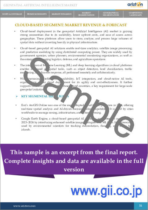
Cloud-based deployment has become the dominant model in the global geospatial artificial intelligence market, offering unparalleled scalability, flexibility, and accessibility for processing vast geospatial datasets. These platforms help companies manage and analyze large location-based datasets more easily. Instead of buying and running powerful computers themselves, organizations can now use the cloud to access the storage and speed they need. A good example is Intel Geospatial, which worked with Amazon Web Services (AWS) to create a cloud-based system. This system uses AI to study data from satellites, drones, and ground sensors. It helps companies in areas like oil and gas or utilities find damaged equipment and environmental problems faster. This saves time and makes operations safer.
Another example is the partnership between Microsoft and Esri. They built a virtual machine called GeoAI Data Science VM on Microsoft's cloud platform, Azure. It combines Esri's mapping software (ArcGIS Pro) with Microsoft's AI tools. Users can do many tasks, like studying land types from satellite images or building complex maps, quickly and with better teamwork, all in the cloud. In summary, cloud-based GeoAI tools are becoming essential. They offer strong computing power, easy access, and lower costs, which help companies in many industries work more efficiently and develop better solutions.
Segmentation by Deployment Mode
- Cloud-based
- On-premises
INSIGHTS BY DATA MODEL
In the global geospatial artificial intelligence market, vector data models have emerged as a dominant force, primarily due to their ability to represent real-world features with precision and clarity. Vector data utilizes points, lines, and polygons to depict various geographic elements, making it particularly effective for applications requiring detailed spatial analysis. For instance, Niantic, the company behind Pokemon Go, has leveraged vector data to create intricate geospatial models of the Earth. By collecting location data from millions of players, Niantic has developed comprehensive 3D maps that enhance the gaming experience and serve as foundational tools for various location-based services. This capability to accurately model and analyze spatial relationships has solidified vector data's prominence in the geospatial artificial intelligence market, enabling more informed decision-making across sectors such as urban planning, navigation, and environmental management.
Segmentation by Data Model
- Vector Data
- Raster Data
- Others
INSIGHTS BY COMPONENT
The global geospatial artificial intelligence market by component is segmented into software, hardware, and services. In the geospatial artificial intelligence (GeoAI) market, software components have emerged as the dominant segment, driven by the escalating demand for advanced geospatial analytics across various industries. These software solutions enable organizations to efficiently process and interpret complex spatial data, facilitating applications such as mapping, predictive analytics, and real-time data visualization.
For example, Esri's ArcGIS platform integrates AI capabilities to provide comprehensive geospatial analysis tools, aiding sectors like urban planning and environmental management in making informed decisions. Similarly, Google's Earth Engine leverages AI to analyze large-scale geospatial datasets, supporting applications in agriculture, forestry, and disaster response. These platforms exemplify how AI-enhanced geospatial software is pivotal in transforming data into actionable insights.
The increasing integration of AI, machine learning, and big data analytics within geospatial software further amplifies its functionalities, enabling businesses to extract valuable information from intricate datasets. This trend underscores the critical role of software in advancing the capabilities and applications of the geospatial artificial intelligence market across diverse sectors.
Segmentation by Component
- Software
- Hardware
- Services
INSIGHTS BY TECHNOLOGY
In the geospatial artificial intelligence market, Machine Learning (ML) has emerged as the dominant technology, revolutionizing how geospatial data is analyzed and utilized. ML-powered algorithms enhance pattern recognition, automate spatial analysis, and improve predictive modeling, making it a crucial tool across industries like urban planning, agriculture, disaster management, and defense.
For example, NASA uses machine learning models to analyze satellite imagery and predict climate patterns, enabling better disaster preparedness. In agriculture, companies like John Deere employ ML-driven geospatial AI to optimize crop health monitoring and yield prediction. Similarly, Google AI integrates ML in Google Earth Engine, allowing environmental researchers to track deforestation and urban expansion with high precision. The ability of ML to process massive geospatial datasets quickly and accurately makes it essential for applications such as real-time flood forecasting, wildfire spread prediction, and automated land use classification. As organizations continue to adopt ML-driven GeoAI solutions, the technology's role in transforming geospatial analytics will only strengthen in the coming years.
Segmentation by Technology
- Machine Learning
- Computer Vision
- Big Data Analytics
- Deep Learning (DL)
- Natural Language Processing (NLP)
- Others
INSIGHTS BY END USERS
The global geospatial artificial intelligence market by end-users is segmented into enterprise and individual. The enterprise sector dominates the market due to its widespread adoption of AI-driven geospatial analytics for decision-making, operational efficiency, and strategic planning. Businesses across industries such as retail, logistics, real estate, agriculture, and finance leverage GeoAI to gain valuable location-based insights and enhance productivity.
For example, Amazon and Walmart use GeoAI-powered supply chain optimization to track shipments, predict demand, and improve warehouse placement. In real estate, companies like Zillow analyze geospatial data to determine property values, market trends, and risk factors such as flooding or urban expansion. Similarly, financial institutions integrate GeoAI for risk assessment, using satellite imagery and AI-driven analytics to monitor economic activities, infrastructure projects, and climate risks affecting investments.
Enterprises benefit from the geospatial artificial intelligence market to process massive datasets in real-time, improving everything from market expansion strategies to environmental compliance. With businesses prioritizing data-driven decisions, the demand for GeoAI solutions in enterprises is expected to keep growing, further solidifying its dominance in the market.
Segmentation by End Users
- Enterprise
- Individual
INSIGHTS BY ENTERPRISE
In the enterprise geospatial artificial intelligence market, the government & public sector is the dominant segment due to the increasing adoption of AI-driven geospatial analytics for urban planning, defense, environmental monitoring, and disaster management. Governments worldwide use GeoAI to improve decision-making, optimize public services, and enhance national security.
For example, the United States Geological Survey (USGS) leverages GeoAI to monitor land use changes, track deforestation, and assess climate risks. Similarly, the European Space Agency (ESA) uses AI-integrated satellite data for disaster resilience, mapping flood-prone areas and wildfire risks in real time. In defense, the Pentagon and NATO rely on GeoAI for surveillance, border security, and threat detection, using AI-enhanced satellite imagery and drone data to monitor geopolitical developments.
In smart city initiatives, governments like Saudi Arabia's NEOM project and India's Smart Cities Mission integrate GeoAI for traffic management, infrastructure planning, and energy efficiency. Public agencies also use GeoAI for agriculture monitoring, as seen in Brazil's National Institute for Space Research (INPE), which applies AI-powered satellite data to track illegal deforestation in the Amazon. With governments prioritizing climate resilience, infrastructure modernization, and national security, the geospatial artificial intelligence market demand in the public sector continues to grow, solidifying its dominance in the market.
Segmentation by Enterprise
- Government & Public Sector
- Agriculture & Forestry
- Energy & Utilities
- Transportation & Logistics
- Defense & Security
- Others
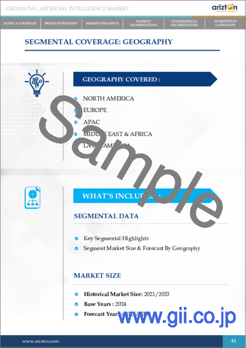
GEOSPATIAL ARTIFICIAL INTELLIGENCE MARKET GEOGRAPHICAL ANALYSIS
In 2024, North America dominated the global geospatial artificial intelligence market, accounting for a share of over 31%. In North America, the United States and Canada are leading in GeoAI adoption, primarily due to strong investments in defense, smart cities, and disaster management. The U.S. Department of Defense uses AI-powered satellite imagery for border security and military intelligence, while agencies like FEMA (Federal Emergency Management Agency) utilize GeoAI to predict and manage natural disasters like hurricanes and wildfires. In Canada, the Smart Cities Challenge has encouraged local governments to integrate AI-driven geospatial analysis for traffic optimization, energy management, and urban planning.
In Europe's geospatial artificial intelligence market, countries like Germany, the UK, and France are leveraging GeoAI for environmental monitoring and climate resilience. The European Space Agency (ESA) has launched AI-integrated satellite programs to track deforestation, air pollution, and water resource management. The UK government also invests in AI-powered geospatial tools for railway optimization and flood mapping to improve national infrastructure planning. Furthermore, Asia-Pacific is experiencing significant growth in the geospatial artificial intelligence market, led by China, India, and Japan. China's Belt and Road Initiative (BRI) uses GeoAI to analyze terrain, optimize construction sites, and improve logistics for large-scale infrastructure projects. India's National Geospatial Policy 2022 has encouraged industries to adopt AI-driven mapping solutions for agriculture, smart city development, and disaster response. Japan integrates GeoAI in earthquake prediction systems, leveraging AI-powered sensors to analyze seismic activities and improve disaster preparedness.
In the Middle East & Africa geospatial artificial intelligence market, Saudi Arabia and the UAE are investing heavily in GeoAI for smart city initiatives and national security. Saudi Arabia's NEOM project, a futuristic smart city, is using AI-driven geospatial analytics for traffic control, energy distribution, and environmental sustainability. The UAE has integrated GeoAI in drone-based surveillance systems for border security and infrastructure monitoring. In Africa, countries like South Africa and Kenya are using GeoAI for agriculture mapping, wildlife conservation, and flood prediction to improve resource management and disaster response.
Furthermore, the Latin American geospatial artificial intelligence market is also witnessing steady growth, with Brazil and Mexico leveraging GeoAI for deforestation tracking, urban expansion analysis, and climate monitoring. Brazil's INPE (National Institute for Space Research) uses AI-powered satellite imagery to combat illegal logging in the Amazon rainforest.
As governments and enterprises across the world increasingly adopt AI-powered geospatial intelligence, the GeoAI market is set to grow, playing a crucial role in urban development, environmental protection, and security enhancements across all major regions.
- North America
- The U.S.
- Canada
- Europe
- The U.K.
- Germany
- France
- Russia
- Spain
- Italy
- Denmark
- Norway
- Poland
- APAC
- China
- India
- Japan
- South Korea
- Australia
- Singapore
- Malaysia
- Latin America
- Brazil
- Mexico
- Argentina
- Middle East & Africa
- Saudi Arabia
- UAE
- South Africa
GEOSPATIAL AI MARKET VENDOR ANALYSIS
The global geospatial artificial intelligence market is highly competitive, with many companies developing advanced AI-powered geospatial solutions to meet the growing demand for smart infrastructure, disaster management, defense, and environmental monitoring. The geospatial AI market includes a mix of large technology companies, satellite imaging firms, AI startups, and government-backed research organizations, all striving to innovate and expand their market presence.
Key players in the global geospatial artificial intelligence market include companies like Esri, Google, Microsoft, Maxar Technologies, Orbital Insight, and Airbus. These companies are investing in AI-driven satellite imaging, geospatial analytics platforms, and real-time data processing technologies to improve accuracy and efficiency in geospatial intelligence. For example, Esri, a leading geographic information system (GIS) provider, integrates AI and machine learning into its ArcGIS platform to help businesses and governments analyze satellite imagery, optimize transportation networks, and manage environmental risks. Google Earth Engine is another powerful GeoAI tool in the geospatial artificial intelligence market that enables real-time environmental monitoring by analyzing vast amounts of satellite and remote sensing data.
Maxar Technologies specializes in high-resolution satellite imaging and uses AI algorithms to detect changes in land use, track deforestation, and monitor infrastructure projects. Airbus has also developed AI-powered Earth observation services to assist governments and businesses in climate monitoring and defense applications. Furthermore, startups like Orbital Insight and SpaceKnow are revolutionizing the geospatial AI market with AI-based predictive analytics. These companies use machine learning to analyze geospatial data from satellites and drones, providing insights for industries like finance, real estate, and agriculture. For instance, Orbital Insight's AI models can estimate crop yields, monitor oil storage facilities, and track urban development trends based on satellite imagery.
Governments and defense agencies also play a significant role in shaping the geospatial artificial intelligence market landscape. Agencies such as NASA, the European Space Agency (ESA), and the Indian Space Research Organisation (ISRO) are actively investing in GeoAI-powered disaster response, climate change monitoring, and national security applications. In the U.S., the Department of Defense (DoD) uses AI-powered geospatial analysis for border security, military planning, and surveillance.
To maintain a competitive edge, companies in the GeoAI market are increasingly focusing on partnerships, acquisitions, and AI-driven innovations. For example, in 2024, Microsoft partnered with Planet Labs to integrate GeoAI into its Azure cloud services, offering businesses and government agencies better access to geospatial intelligence tools. Similarly, Amazon Web Services (AWS) has been expanding its GeoAI capabilities by collaborating with satellite data providers to offer real-time geospatial analytics for enterprises. Furthermore, as demand for AI-driven geospatial intelligence continues to grow, competition in the geospatial artificial intelligence market is expected to intensify. Companies that invest in advanced AI models, real-time analytics, and cloud-based geospatial services will likely dominate the market, driving innovation and shaping the future of the GeoAI industry.
Key Companies
- Esri
- Hexagon AB
- Maxar Technologies
- Google LLC (Alphabet Inc.)
- Microsoft Corporation
- IBM
- Trimble Inc.
- Autodesk, Inc.
- Bentley Systems, Incorporated
- Amazon Web Services, Inc. (AWS)
- Airbus
- Planet Labs PBC
- Orbital Insight, Inc.
- Descartes Labs, Inc.
Other Prominent Company Profiles
- Satellogic Inc.
- Palantir Technologies Inc.
- Blue Sky Analytics
- Sparkgeo
- GeoIQ
- 1Spatial
- Agronomeye
- AiDash
- Alcis Holdings Ltd.
- Anditi
- ASTERRA
- Atlas AI P.B.C.
- Mapbox, Inc.
- TomTom
- HERE Technologies
- CARTO
- L3Harris Technologies, Inc.
- TerraGo
- Blue Marble Geographics
- Northrop Grumman Corporation
KEY QUESTIONS ANSWERED:
1. How big is the global geospatial artificial intelligence market?
2. What is the growth rate of the global geospatial artificial intelligence market?
3. Who are the key players in the global geospatial artificial intelligence market?
4. What are the significant trends in the geospatial artificial intelligence market?
5. Which region dominates the global geospatial artificial intelligence market share?
TABLE OF CONTENTS
1. SCOPE & COVERAGE
- 1.1. MARKET DERIVATION
- 1.2. MARKET DEFINITION
- 1.3. SEGMENT COVERAGE & DEFINITION
2. PREMIUM INSIGHTS
- 2.1. OPPORTUNITY POCKET
- 2.2. KEY MARKET HIGHLIGHTS
- 2.3. REGIONAL INSIGHTS
3. MARKET DYNAMICS
- 3.1. OPPORTUNITY & TRENDS
- 3.2. MARKET ENABLERS
- 3.3. MARKET RESTRAINTS
- 3.4. INTRODUCTION
- 3.5. MARKET LANDSCAPE
4. MARKET SEGMENTATION
- 4.1. DEPLOYMENT MODE
- 4.2. DATA MODEL
- 4.3. COMPONENT
- 4.4. TECHNOLOGY
- 4.5. END USER
5. GEOGRAPHICAL SEGMENTATION
- 5.1. ASIA PACIFIC (APAC)
- 5.2. NORTH AMERICA
- 5.3. EUROPE
- 5.4. LATIN AMERICA
- 5.5. MIDDLE EAST & AFRICA
6. COMPETITIVE LANDSCAPE
- 6.1. COMPETITIVE SCENARIO
- 6.2. MARKET SHARE ANALYSIS
- 6.3. KEY COMPANY PROFILES
- 6.4. OTHER PROMINENT COMPANY PROFILE
